San Antonio geodata
San Antonio (Hidalgo) is a populated place; located in Mexico in America/Mexico_City (GMT-6) time zone. With population of 701 people, there are 12418 cities with bigger population in this country. Compared to other cities in Mexico, 74.7% of cities are located further ↓South; 53.1% of cities are located further ←West and 51.9% of cities have lower elevation than San Antonio. Note1


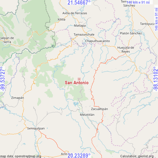
San Antonio GPS coordinates[2]
20° 53' 28.392" North, 98° 50' 2.904" West
| Map corner | latitude | longitude |
|---|---|---|
| Upper-left | 21.54667°, | -99.53727° |
| Center: | 20.89122°, | -98.83414° |
| Lower-right: | 20.23289°, | -98.13102° |
| Map W x H: | 146.1×146.1 km | = 90.8×90.8mi |
| max Lat: | 32.7° ⇑25.3% North |
| San Antonio: | 20.89122° |
| min Lat: | ⇓74.7% South 14.53588° |
| min Long | San Antonio | max Long |
| -117.105° | -98.83414° | -86.73105° |
| W 53.1%⇐ | ⇒46.9% E |
Elevation
Elevation of San Antonio is 1521 m = 4990 ft, and this is 267.3 m = 877 ft above average elevation for this country.
| Max E: |
3497 m = 11473 ft | 48.1% |
| San Antonio | 1521 m 4990 ft | |
| Avg. | 1253.7 m = 4113 ft | |
Min E: |
-1 m = -3 ft | 51.9% |
See also: Mexico elevation on elevation.city.
Geographical zone
San Antonio is located in North Torrid zone (between Equator and Tropic of Cancer). Distance of this Northern Tropic circle is 283 km =175.8 mi to North.| Distance of | km | miles | from San Antonio |
|---|---|---|---|
| North Pole | 7684.2 | 4774.7 | to North |
| Arctic Circle | 5078.3 | 3155.5 | to North |
| Tropic Cancer | 283 | 175.8 | to North |
| Equator | 2322.9 | 1443.4 | to South |


Nearby cities:
15 places around San Antonio: (largest is in red/bold)
• Acayuca
9.9 km =6.2 mi,  34°
34°
• Acoxcatlán
10.8 km =6.7 mi, 32°
• Chilijapa
13.8 km =8.6 mi,  344°
344°
• Coyocala
9.5 km =5.9 mi,  315°
315°
• Cuazahuatl
15 km =9.3 mi, 338°
• Cuxhuacan
9 km =5.6 mi,  11°
11°
• Ixculculla
7.8 km =4.8 mi,  352°
352°
• Ixtlahuaca
13.6 km =8.5 mi,  93°
93°
• Lototla
13.3 km =8.3 mi,  114°
114°
• San Miguel Ayotempa
9.6 km =6 mi, 349°
• San Nicolás Cuatzontla
2.9 km =1.8 mi,  214°
214°
• Santa María
6.3 km =3.9 mi,  223°
223°
• Tamala
12.3 km =7.6 mi,  16°
16°
• Tepehuacán de Guerrero
13.6 km =8.5 mi,  356°
356°
• Tolago
14.6 km =9.1 mi,  48°
48°
Sources, notices
• [Note1] Compared only with cities in Mexico existing in our database
• [Src1] Map data: © OpenStreetMap contributors (CC-BY-SA)
• [Src2] Other city data from geonames.org with taken over terms of usage.
• [Src3] Geographical zone / Annual Mean Temperature by Robert A. Rohde @ Wikipedia
