Alpotzonga de Lira y Ortega geodata
Alpotzonga de Lira y Ortega (Puebla) is a populated place; located in Mexico in America/Mexico_City (GMT-6) time zone. With population of 961 people, there are 9056 cities with bigger population in this country. Compared to other cities in Mexico, 57% of cities are located further ↑North; 58.2% of cities are located further ←West and 93% of cities have lower elevation than Alpotzonga de Lira y Ortega. Note1
Current local time in Alpotzonga de Lira y Ortega:
06:56 AM, WednesdayDifference from your time zone: hours


Alpotzonga de Lira y Ortega GPS coordinates[2]
19° 22' 17.688" North, 98° 25' 58.224" West
| Map corner | latitude | longitude |
|---|---|---|
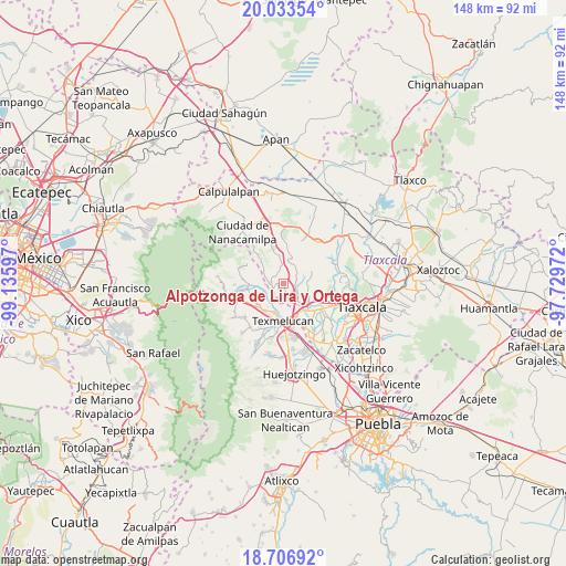
| Upper-left | 20.03354°, | -99.13597° |
| Center: | 19.37158°, | -98.43284° |
| Lower-right: | 18.70692°, | -97.72972° |
| Map W x H: | 147.5×147.5 km | = 91.7×91.7mi |
| max Lat: | 32.7° ⇑57% North |
| Alpotzonga de Lira y Ortega: | 19.37158° |
| min Lat: | ⇓43% South 14.53588° |
| min Long | Alpotzonga de L | max Long |
| -117.105° | -98.43284° | -86.73105° |
| W 58.2%⇐ | ⇒41.8% E |
Elevation
Elevation of Alpotzonga de Lira y Ortega is 2533 m = 8310 ft, and this is 1279.3 m = 4197 ft above average elevation for this country.
| Max E: |
3497 m = 11473 ft | 7% |
| Alpotzonga de Lira y Ortega | 2533 m 8310 ft | |
| Avg. | 1253.7 m = 4113 ft | |
Min E: |
-1 m = -3 ft | 93% |
See also: Mexico elevation on elevation.city.
Geographical zone
Alpotzonga de Lira y Ortega is located in North Torrid zone (between Equator and Tropic of Cancer). Distance of this Northern Tropic circle is 452 km =280.9 mi to North.| Distance of | km | miles | from Alpotzonga de Lira y Ortega |
|---|---|---|---|
| North Pole | 7853.1 | 4879.7 | to North |
| Arctic Circle | 5247.3 | 3260.5 | to North |
| Tropic Cancer | 452 | 280.9 | to North |
| Equator | 2153.9 | 1338.4 | to South |


Nearby cities:
15 places around Alpotzonga de Lira y Ortega: (largest is in red/bold)
• Espíritu Santo
3.7 km =2.3 mi,  170°
170°
• Juárez Coronaco
9.7 km =6 mi,  262°
262°
• Palmillas
9.8 km =6.1 mi,  233°
233°
• San Antonio Atotonilco
3.5 km =2.2 mi,  275°
275°
• San Francisco Mitepec
7.7 km =4.8 mi,  347°
347°
• San Francisco Tláloc
4.7 km =2.9 mi,  267°
267°
• San Lucas el Grande
8.7 km =5.4 mi,  213°
213°
• San Marcos Jilotepec
6.2 km =3.9 mi,  83°
83°
• San Martin Texmelucan de Labastida
9.7 km =6 mi,  183°
183°
• San Matias Tlalancaleca
8.6 km =5.3 mi, 233°
• San Rafael Tlanalapan
9.6 km =6 mi,  202°
202°
• Vicente Guerrero
8.2 km =5.1 mi,  312°
312°
• Villa Alta
9.4 km =5.8 mi,  159°
159°
• Villa Mariano Matamoros
7.6 km =4.7 mi,  131°
131°
• Xocoyucan
9.2 km =5.7 mi,  138°
138°
Sources, notices
• [Note1] Compared only with cities in Mexico existing in our database
• [Src1] Map data: © OpenStreetMap contributors (CC-BY-SA)
• [Src2] Other city data from geonames.org with taken over terms of usage.
• [Src3] Geographical zone / Annual Mean Temperature by Robert A. Rohde @ Wikipedia
