Xocoyucan geodata
Xocoyucan (Tlaxcala) is a populated place; located in Mexico in America/Mexico_City (GMT-6) time zone. With population of 3,628 people, there are 2527 cities with bigger population in this country. Compared to other cities in Mexico, 58.6% of cities are located further ↑North; 59% of cities are located further ←West and 83.3% of cities have lower elevation than Xocoyucan. Note1


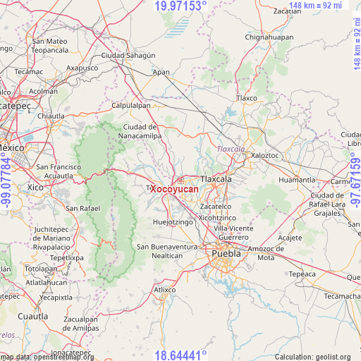
Xocoyucan GPS coordinates[2]
19° 18' 33.552" North, 98° 22' 28.956" West
| Map corner | latitude | longitude |
|---|---|---|
| Upper-left | 19.97153°, | -99.07784° |
| Center: | 19.30932°, | -98.37471° |
| Lower-right: | 18.64441°, | -97.67159° |
| Map W x H: | 147.6×147.6 km | = 91.7×91.7mi |
| max Lat: | 32.7° ⇑58.6% North |
| Xocoyucan: | 19.30932° |
| min Lat: | ⇓41.4% South 14.53588° |
| min Long | Xocoyucan | max Long |
| -117.105° | -98.37471° | -86.73105° |
| W 59%⇐ | ⇒41% E |
Elevation
Elevation of Xocoyucan is 2227 m = 7306 ft, and this is 973.3 m = 3193 ft above average elevation for this country.
| Max E: |
3497 m = 11473 ft | 16.7% |
| Xocoyucan | 2227 m 7306 ft | |
| Avg. | 1253.7 m = 4113 ft | |
Min E: |
-1 m = -3 ft | 83.3% |
See also: Mexico elevation on elevation.city.
Geographical zone
Xocoyucan is located in North Torrid zone (between Equator and Tropic of Cancer). Distance of this Northern Tropic circle is 458.9 km =285.1 mi to North.| Distance of | km | miles | from Xocoyucan |
|---|---|---|---|
| North Pole | 7860.1 | 4884 | to North |
| Arctic Circle | 5254.2 | 3264.8 | to North |
| Tropic Cancer | 458.9 | 285.1 | to North |
| Equator | 2147 | 1334.1 | to South |


Nearby cities:
15 places around Xocoyucan: (largest is in red/bold)
• Espíritu Santo
6.4 km =4 mi,  300°
300°
• Guadalupe Victoria
3.5 km =2.2 mi,  199°
199°
• San Antonio Tecoac
5.5 km =3.4 mi,  65°
65°
• San Jorge Tezoquipan
6.6 km =4.1 mi,  78°
78°
• San José Atoyatenco
6.8 km =4.2 mi,  162°
162°
• San Mateo Ayecac
4 km =2.5 mi,  211°
211°
• San Rafael Tenanyecac
6.8 km =4.2 mi,  176°
176°
• Santa Ana Nopalucan
4.5 km =2.8 mi,  105°
105°
• Santa Cruz el Porvenir
3.8 km =2.4 mi,  48°
48°
• Santa Inés Tecuexcomac
3.4 km =2.1 mi,  120°
120°
• Santa Justina Ecatepec
2.1 km =1.3 mi,  85°
85°
• Santiago Xochimilco
6.1 km =3.8 mi,  55°
55°
• Tepetitla
4.9 km =3 mi, 182°
• Villa Alta
3.3 km =2.1 mi,  236°
236°
• Villa Mariano Matamoros
2 km =1.2 mi,  348°
348°
Sources, notices
• [Note1] Compared only with cities in Mexico existing in our database
• [Src1] Map data: © OpenStreetMap contributors (CC-BY-SA)
• [Src2] Other city data from geonames.org with taken over terms of usage.
• [Src3] Geographical zone / Annual Mean Temperature by Robert A. Rohde @ Wikipedia
