Miguel Hidalgo geodata
Miguel Hidalgo (Chiapas) is a populated place; located in Mexico in America/Mexico_City (GMT-6) time zone. With population of 650 people, there are 13331 cities with bigger population in this country. Compared to other cities in Mexico, 82.8% of cities are located further ↑North; 95.8% of cities are located further ←West and 82.3% of cities have higher elevation than Miguel Hidalgo. Note1


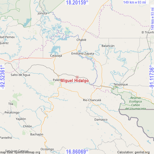
Miguel Hidalgo GPS coordinates[2]
17° 31' 56.568" North, 91° 49' 13.728" West
| Map corner | latitude | longitude |
|---|---|---|
| Upper-left | 18.20159°, | -92.52361° |
| Center: | 17.53238°, | -91.82048° |
| Lower-right: | 16.86069°, | -91.11736° |
| Map W x H: | 149.1×149.1 km | = 92.6×92.6mi |
| max Lat: | 32.7° ⇑82.8% North |
| Miguel Hidalgo: | 17.53238° |
| min Lat: | ⇓17.2% South 14.53588° |
| min Long | Miguel Hidalgo | max Long |
| -117.105° | -91.82048° | -86.73105° |
| W 95.8%⇐ | ⇒4.2% E |
Elevation
Elevation of Miguel Hidalgo is 67 m = 220 ft, and this is 1186.7 m = 3893 ft below average elevation for this country.
| Max E: |
3497 m = 11473 ft | 82.3% |
| Avg. | 1253.7 m = 4113 ft | |
| Miguel Hidalgo | 67 m = 220 ft | |
Min E: |
-1 m = -3 ft | 17.7% |
See also: Mexico elevation on elevation.city.
Geographical zone
Miguel Hidalgo is located in North Torrid zone (between Equator and Tropic of Cancer). Distance of this Northern Tropic circle is 656.5 km =407.9 mi to North.| Distance of | km | miles | from Miguel Hidalgo |
|---|---|---|---|
| North Pole | 8057.6 | 5006.8 | to North |
| Arctic Circle | 5451.8 | 3387.6 | to North |
| Tropic Cancer | 656.5 | 407.9 | to North |
| Equator | 1949.4 | 1211.3 | to South |


Nearby cities:
15 places around Miguel Hidalgo: (largest is in red/bold)
• Arimatea
22 km =13.7 mi,  195°
195°
• Babilonia
19 km =11.8 mi,  252°
252°
• Belisario Domínguez
22.3 km =13.9 mi,  230°
230°
• Benito Juárez Centro
15.2 km =9.4 mi,  59°
59°
• Doctor Samuel León Brindis
16 km =9.9 mi, 227°
• El Desierto
17.6 km =10.9 mi,  128°
128°
• Estrella de Belén
21.8 km =13.5 mi,  222°
222°
• José María Morelos y Pavón Centro
16.6 km =10.3 mi,  3°
3°
• La Aurora
19.8 km =12.3 mi, 219°
• La Cascada
18 km =11.2 mi,  174°
174°
• La Libertad
20.2 km =12.6 mi,  31°
31°
• Nazareth
22.4 km =13.9 mi, 217°
• Nuevo Sonora
14.1 km =8.8 mi,  209°
209°
• Palenque
17.4 km =10.8 mi,  261°
261°
• San Juan Chancalaíto
23.3 km =14.5 mi,  154°
154°
Sources, notices
• [Note1] Compared only with cities in Mexico existing in our database
• [Src1] Map data: © OpenStreetMap contributors (CC-BY-SA)
• [Src2] Other city data from geonames.org with taken over terms of usage.
• [Src3] Geographical zone / Annual Mean Temperature by Robert A. Rohde @ Wikipedia
