Chapallal Grande geodata
Chapallal Grande (Chiapas) is a populated place; located in Mexico in America/Mexico_City (GMT-6) time zone. With population of 1,112 people, there are 7813 cities with bigger population in this country. Compared to other cities in Mexico, 85.3% of cities are located further ↑North; 89% of cities are located further ←West and 63.5% of cities have higher elevation than Chapallal Grande. Note1


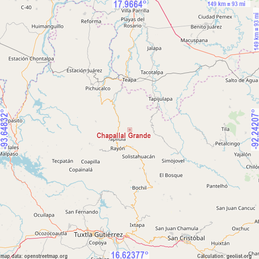
Chapallal Grande GPS coordinates[2]
17° 17' 46.716" North, 92° 56' 42.684" West
| Map corner | latitude | longitude |
|---|---|---|
| Upper-left | 17.9664°, | -93.64832° |
| Center: | 17.29631°, | -92.94519° |
| Lower-right: | 16.62377°, | -92.24207° |
| Map W x H: | 149.3×149.3 km | = 92.8×92.8mi |
| max Lat: | 32.7° ⇑85.3% North |
| Chapallal Grande: | 17.29631° |
| min Lat: | ⇓14.7% South 14.53588° |
| min Long | Chapallal Grand | max Long |
| -117.105° | -92.94519° | -86.73105° |
| W 89%⇐ | ⇒11% E |
Elevation
Elevation of Chapallal Grande is 781 m = 2562 ft, and this is 472.7 m = 1551 ft below average elevation for this country.
| Max E: |
3497 m = 11473 ft | 63.5% |
| Avg. | 1253.7 m = 4113 ft | |
| Chapallal Grande | 781 m = 2562 ft | |
Min E: |
-1 m = -3 ft | 36.5% |
See also: Mexico elevation on elevation.city.
Geographical zone
Chapallal Grande is located in North Torrid zone (between Equator and Tropic of Cancer). Distance of this Northern Tropic circle is 682.7 km =424.2 mi to North.| Distance of | km | miles | from Chapallal Grande |
|---|---|---|---|
| North Pole | 8083.9 | 5023.1 | to North |
| Arctic Circle | 5478 | 3403.9 | to North |
| Tropic Cancer | 682.7 | 424.2 | to North |
| Equator | 1923.2 | 1195 | to South |


Nearby cities:
15 places around Chapallal Grande: (largest is in red/bold)
• Cerro las Campanas
5.2 km =3.2 mi,  325°
325°
• El Pinabeto
10 km =6.2 mi,  188°
188°
• El Porvenir Tres Picos
9.5 km =5.9 mi,  59°
59°
• Ignacio Zaragoza
1 km =0.6 mi,  132°
132°
• Ixhuatán
6.7 km =4.2 mi,  267°
267°
• La Florida
5.6 km =3.5 mi, 186°
• Lázaro Cárdenas
9.5 km =5.9 mi,  1°
1°
• Monte Horeb
8.2 km =5.1 mi,  310°
310°
• Rincón Chamula
9.9 km =6.2 mi,  176°
176°
• San Antonio Tres Picos
9.4 km =5.8 mi,  71°
71°
• San Francisco Jaconá
10 km =6.2 mi,  248°
248°
• San José Chapayal
5.8 km =3.6 mi,  85°
85°
• Santa Anita
3.5 km =2.2 mi, 272°
• Tapilula
9.2 km =5.7 mi,  235°
235°
• Villaflores
6.9 km =4.3 mi,  346°
346°
Sources, notices
• [Note1] Compared only with cities in Mexico existing in our database
• [Src1] Map data: © OpenStreetMap contributors (CC-BY-SA)
• [Src2] Other city data from geonames.org with taken over terms of usage.
• [Src3] Geographical zone / Annual Mean Temperature by Robert A. Rohde @ Wikipedia
