Monte Grande geodata
Monte Grande (Chiapas) is a populated place; located in Mexico in America/Mexico_City (GMT-6) time zone. With population of 688 people, there are 12631 cities with bigger population in this country. Compared to other cities in Mexico, 89.8% of cities are located further ↑North; 89.4% of cities are located further ←West and 60.2% of cities have lower elevation than Monte Grande. Note1


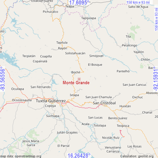
Monte Grande GPS coordinates[2]
16° 56' 17.124" North, 92° 51' 44.748" West
| Map corner | latitude | longitude |
|---|---|---|
| Upper-left | 17.6095°, | -93.56556° |
| Center: | 16.93809°, | -92.86243° |
| Lower-right: | 16.26428°, | -92.15931° |
| Map W x H: | 149.6×149.6 km | = 93×93mi |
| max Lat: | 32.7° ⇑89.8% North |
| Monte Grande: | 16.93809° |
| min Lat: | ⇓10.2% South 14.53588° |
| min Long | Monte Grande | max Long |
| -117.105° | -92.86243° | -86.73105° |
| W 89.4%⇐ | ⇒10.6% E |
Elevation
Elevation of Monte Grande is 1729 m = 5673 ft, and this is 475.3 m = 1559 ft above average elevation for this country.
| Max E: |
3497 m = 11473 ft | 39.8% |
| Monte Grande | 1729 m 5673 ft | |
| Avg. | 1253.7 m = 4113 ft | |
Min E: |
-1 m = -3 ft | 60.2% |
See also: Mexico elevation on elevation.city.
Geographical zone
Monte Grande is located in North Torrid zone (between Equator and Tropic of Cancer). Distance of this Northern Tropic circle is 722.6 km =449 mi to North.| Distance of | km | miles | from Monte Grande |
|---|---|---|---|
| North Pole | 8123.7 | 5047.8 | to North |
| Arctic Circle | 5517.8 | 3428.6 | to North |
| Tropic Cancer | 722.6 | 449 | to North |
| Equator | 1883.3 | 1170.2 | to South |


Nearby cities:
15 places around Monte Grande: (largest is in red/bold)
• Bochil
7.2 km =4.5 mi,  333°
333°
• Buenavista
1.8 km =1.1 mi,  110°
110°
• Chuchiltón
4 km =2.5 mi,  56°
56°
• Chuchiltón Anexo Potobtic Dos
4.2 km =2.6 mi,  20°
20°
• El Copal
7.5 km =4.7 mi,  295°
295°
• El Nopal
3.5 km =2.2 mi,  147°
147°
• Majoval
7.4 km =4.6 mi,  32°
32°
• Pugchén Mumuntic
9.2 km =5.7 mi, 153°
• San Cristobalito
5.4 km =3.4 mi,  122°
122°
• San Vicente
6.8 km =4.2 mi,  286°
286°
• Soyaló
8.4 km =5.2 mi,  231°
231°
• Stenlejsotztetic
4 km =2.5 mi, 105°
• Venustiano Carranza
7.6 km =4.7 mi, 289°
• Victórico R. Grajales (Iglesia Vieja)
5 km =3.1 mi,  209°
209°
• Yerbabuena Isbontick
0.7 km =0.4 mi, 212°
Sources, notices
• [Note1] Compared only with cities in Mexico existing in our database
• [Src1] Map data: © OpenStreetMap contributors (CC-BY-SA)
• [Src2] Other city data from geonames.org with taken over terms of usage.
• [Src3] Geographical zone / Annual Mean Temperature by Robert A. Rohde @ Wikipedia
