La Libertad geodata
La Libertad (Chiapas) is a populated place; located in Mexico in America/Mexico_City (GMT-6) time zone. With population of 802 people, there are 10884 cities with bigger population in this country. Compared to other cities in Mexico, 92.7% of cities are located further ↑North; 93.1% of cities are located further ←West and 69.1% of cities have lower elevation than La Libertad. Note1


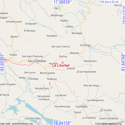
La Libertad GPS coordinates[2]
16° 42' 58.212" North, 92° 21' 2.88" West
| Map corner | latitude | longitude |
|---|---|---|
| Upper-left | 17.38838°, | -93.05393° |
| Center: | 16.71617°, | -92.3508° |
| Lower-right: | 16.04158°, | -91.64768° |
| Map W x H: | 149.8×149.8 km | = 93.1×93.1mi |
| max Lat: | 32.7° ⇑92.7% North |
| La Libertad: | 16.71617° |
| min Lat: | ⇓7.3% South 14.53588° |
| min Long | La Libertad | max Long |
| -117.105° | -92.3508° | -86.73105° |
| W 93.1%⇐ | ⇒6.9% E |
Elevation
Elevation of La Libertad is 1909 m = 6263 ft, and this is 655.3 m = 2150 ft above average elevation for this country.
| Max E: |
3497 m = 11473 ft | 30.9% |
| La Libertad | 1909 m 6263 ft | |
| Avg. | 1253.7 m = 4113 ft | |
Min E: |
-1 m = -3 ft | 69.1% |
See also: Mexico elevation on elevation.city.
Geographical zone
La Libertad is located in North Torrid zone (between Equator and Tropic of Cancer). Distance of this Northern Tropic circle is 747.3 km =464.4 mi to North.| Distance of | km | miles | from La Libertad |
|---|---|---|---|
| North Pole | 8148.4 | 5063.2 | to North |
| Arctic Circle | 5542.5 | 3443.9 | to North |
| Tropic Cancer | 747.3 | 464.4 | to North |
| Equator | 1858.7 | 1154.9 | to South |


Nearby cities:
15 places around La Libertad: (largest is in red/bold)
• Adolfo López Mateos
7.8 km =4.8 mi,  299°
299°
• Buenavista
10.2 km =6.3 mi,  237°
237°
• Carmen Yalchuch
8 km =5 mi,  188°
188°
• Chanal
5.2 km =3.2 mi,  270°
270°
• El Retiro
9 km =5.6 mi,  352°
352°
• Guadalupe Bacja
10.4 km =6.5 mi,  92°
92°
• La Independencia
1.4 km =0.9 mi,  45°
45°
• Los Pozos
9.7 km =6 mi,  218°
218°
• Oxchuc
7.8 km =4.8 mi,  4°
4°
• Rancho del Cura
10.8 km =6.7 mi,  84°
84°
• San Andrés Puerto Rico
5.9 km =3.7 mi,  251°
251°
• San Fernando
7.2 km =4.5 mi,  123°
123°
• San Gregorio de las Casas
5.2 km =3.2 mi,  231°
231°
• San Pedro Pedernal
6.6 km =4.1 mi,  152°
152°
• Tzopilja
5.1 km =3.2 mi,  59°
59°
Sources, notices
• [Note1] Compared only with cities in Mexico existing in our database
• [Src1] Map data: © OpenStreetMap contributors (CC-BY-SA)
• [Src2] Other city data from geonames.org with taken over terms of usage.
• [Src3] Geographical zone / Annual Mean Temperature by Robert A. Rohde @ Wikipedia
