San Pedro Pedernal geodata
San Pedro Pedernal (Chiapas) is a populated place; located in Mexico in America/Mexico_City (GMT-6) time zone. With population of 942 people, there are 9249 cities with bigger population in this country. Compared to other cities in Mexico, 93.1% of cities are located further ↑North; 93.2% of cities are located further ←West and 65.1% of cities have lower elevation than San Pedro Pedernal. Note1


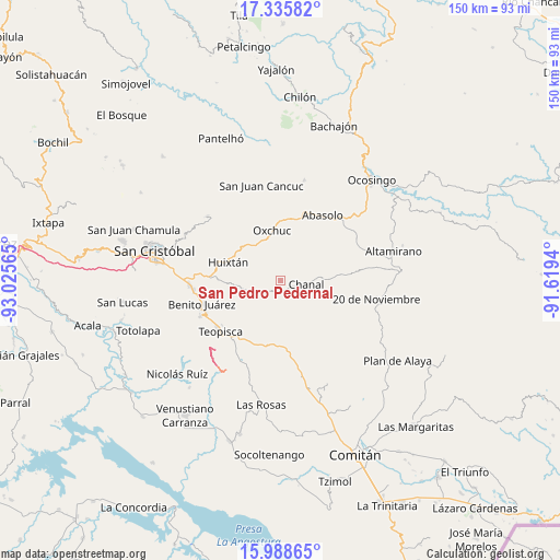
San Pedro Pedernal GPS coordinates[2]
16° 39' 48.312" North, 92° 19' 21.072" West
| Map corner | latitude | longitude |
|---|---|---|
| Upper-left | 17.33582°, | -93.02565° |
| Center: | 16.66342°, | -92.32252° |
| Lower-right: | 15.98865°, | -91.6194° |
| Map W x H: | 149.8×149.8 km | = 93.1×93.1mi |
| max Lat: | 32.7° ⇑93.1% North |
| San Pedro Pedernal: | 16.66342° |
| min Lat: | ⇓6.9% South 14.53588° |
| min Long | San Pedro Peder | max Long |
| -117.105° | -92.32252° | -86.73105° |
| W 93.2%⇐ | ⇒6.8% E |
Elevation
Elevation of San Pedro Pedernal is 1831 m = 6007 ft, and this is 577.3 m = 1894 ft above average elevation for this country.
| Max E: |
3497 m = 11473 ft | 34.9% |
| San Pedro Pedernal | 1831 m 6007 ft | |
| Avg. | 1253.7 m = 4113 ft | |
Min E: |
-1 m = -3 ft | 65.1% |
See also: Mexico elevation on elevation.city.
Geographical zone
San Pedro Pedernal is located in North Torrid zone (between Equator and Tropic of Cancer). Distance of this Northern Tropic circle is 753.1 km =468 mi to North.| Distance of | km | miles | from San Pedro Pedernal |
|---|---|---|---|
| North Pole | 8154.3 | 5066.8 | to North |
| Arctic Circle | 5548.4 | 3447.6 | to North |
| Tropic Cancer | 753.1 | 468 | to North |
| Equator | 1852.8 | 1151.3 | to South |


Nearby cities:
15 places around San Pedro Pedernal: (largest is in red/bold)
• Buenavista
11.7 km =7.3 mi,  271°
271°
• Carmen Yalchuch
4.7 km =2.9 mi,  244°
244°
• Chanal
7 km =4.3 mi,  95°
95°
• Chanal
10.2 km =6.3 mi,  305°
305°
• Guadalupe Bacja
9.2 km =5.7 mi,  53°
53°
• La Independencia
7.1 km =4.4 mi,  343°
343°
• La Libertad
6.6 km =4.1 mi,  332°
332°
• Los Pozos
9.2 km =5.7 mi,  259°
259°
• Rancho del Cura
10.4 km =6.5 mi, 48°
• San Andrés Puerto Rico
9.4 km =5.8 mi,  294°
294°
• San Fernando
3.5 km =2.2 mi,  57°
57°
• San Gregorio de las Casas
7.6 km =4.7 mi, 290°
• San José Yashitinín
13.1 km =8.1 mi, 265°
• Siberia
5.9 km =3.7 mi,  148°
148°
• Tzopilja
8.6 km =5.3 mi,  9°
9°
Sources, notices
• [Note1] Compared only with cities in Mexico existing in our database
• [Src1] Map data: © OpenStreetMap contributors (CC-BY-SA)
• [Src2] Other city data from geonames.org with taken over terms of usage.
• [Src3] Geographical zone / Annual Mean Temperature by Robert A. Rohde @ Wikipedia
