Joaquín Miguel Gutiérrez geodata
Joaquín Miguel Gutiérrez (Chiapas) is a populated place; located in Mexico in America/Mexico_City (GMT-6) time zone. With population of 567 people, there are 15067 cities with bigger population in this country. Compared to other cities in Mexico, 91.5% of cities are located further ↑North; 95.1% of cities are located further ←West and 59.9% of cities have higher elevation than Joaquín Miguel Gutiérrez. Note1
Current local time in Joaquín Miguel Gutiérrez:
08:59 AM, MondayDifference from your time zone: hours


Joaquín Miguel Gutiérrez GPS coordinates[2]
16° 49' 5.088" North, 92° 2' 2.328" West
| Map corner | latitude | longitude |
|---|---|---|
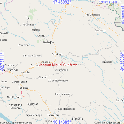
| Upper-left | 17.48992°, | -92.73711° |
| Center: | 16.81808°, | -92.03398° |
| Lower-right: | 16.14385°, | -91.33086° |
| Map W x H: | 149.7×149.7 km | = 93×93mi |
| max Lat: | 32.7° ⇑91.5% North |
| Joaquín Miguel Gutiérrez: | 16.81808° |
| min Lat: | ⇓8.5% South 14.53588° |
| min Long | Joaquín Miguel | max Long |
| -117.105° | -92.03398° | -86.73105° |
| W 95.1%⇐ | ⇒4.9% E |
Elevation
Elevation of Joaquín Miguel Gutiérrez is 1007 m = 3304 ft, and this is 246.7 m = 809 ft below average elevation for this country.
| Max E: |
3497 m = 11473 ft | 59.9% |
| Avg. | 1253.7 m = 4113 ft | |
| Joaquín Miguel Gutiérrez | 1007 m = 3304 ft | |
Min E: |
-1 m = -3 ft | 40.1% |
See also: Mexico elevation on elevation.city.
Geographical zone
Joaquín Miguel Gutiérrez is located in North Torrid zone (between Equator and Tropic of Cancer). Distance of this Northern Tropic circle is 735.9 km =457.3 mi to North.| Distance of | km | miles | from Joaquín Miguel Gutiérrez |
|---|---|---|---|
| North Pole | 8137.1 | 5056.2 | to North |
| Arctic Circle | 5531.2 | 3436.9 | to North |
| Tropic Cancer | 735.9 | 457.3 | to North |
| Equator | 1870 | 1162 | to South |


Nearby cities:
15 places around Joaquín Miguel Gutiérrez: (largest is in red/bold)
• Altamirano
9.3 km =5.8 mi,  182°
182°
• Altamirano
14.3 km =8.9 mi,  300°
300°
• Chulna
16.4 km =10.2 mi,  258°
258°
• Cuxuljá
14.6 km =9.1 mi,  267°
267°
• La Laguna
16.5 km =10.3 mi,  146°
146°
• La Virginia
16.3 km =10.1 mi,  293°
293°
• Los Pinos
13.9 km =8.6 mi,  325°
325°
• Morelia (Victórico Rodolfo Grajales)
12.7 km =7.9 mi, 146°
• Nuevo Jerusalén
8.7 km =5.4 mi,  5°
5°
• Nuevo Paraíso
8.8 km =5.5 mi, 333°
• Nuevo San Carlos
15.6 km =9.7 mi, 152°
• Ocosingo
11.7 km =7.3 mi, 327°
• Palomar 2
18.2 km =11.3 mi, 272°
• Patria Nueva (San José el Contento)
14.9 km =9.3 mi, 325°
• Sibacá
16.9 km =10.5 mi,  318°
318°
Sources, notices
• [Note1] Compared only with cities in Mexico existing in our database
• [Src1] Map data: © OpenStreetMap contributors (CC-BY-SA)
• [Src2] Other city data from geonames.org with taken over terms of usage.
• [Src3] Geographical zone / Annual Mean Temperature by Robert A. Rohde @ Wikipedia
