Quistajito geodata
Quistajito (Chiapas) is a populated place; located in Mexico in America/Mexico_City (GMT-6) time zone. With population of 602 people, there are 14290 cities with bigger population in this country. Compared to other cities in Mexico, 96.1% of cities are located further ↑North; 95.2% of cities are located further ←West and 52.1% of cities have lower elevation than Quistajito. Note1


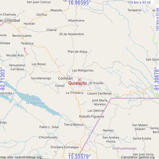
Quistajito GPS coordinates[2]
16° 13' 55.308" North, 92° 0' 35.64" West
| Map corner | latitude | longitude |
|---|---|---|
| Upper-left | 16.90595°, | -92.71303° |
| Center: | 16.23203°, | -92.0099° |
| Lower-right: | 15.55579°, | -91.30678° |
| Map W x H: | 150.1×150.1 km | = 93.3×93.3mi |
| max Lat: | 32.7° ⇑96.1% North |
| Quistajito: | 16.23203° |
| min Lat: | ⇓3.9% South 14.53588° |
| min Long | Quistajito | max Long |
| -117.105° | -92.0099° | -86.73105° |
| W 95.2%⇐ | ⇒4.8% E |
Elevation
Elevation of Quistajito is 1527 m = 5010 ft, and this is 273.3 m = 897 ft above average elevation for this country.
| Max E: |
3497 m = 11473 ft | 47.9% |
| Quistajito | 1527 m 5010 ft | |
| Avg. | 1253.7 m = 4113 ft | |
Min E: |
-1 m = -3 ft | 52.1% |
See also: Mexico elevation on elevation.city.
Geographical zone
Quistajito is located in North Torrid zone (between Equator and Tropic of Cancer). Distance of this Northern Tropic circle is 801.1 km =497.8 mi to North.| Distance of | km | miles | from Quistajito |
|---|---|---|---|
| North Pole | 8202.2 | 5096.6 | to North |
| Arctic Circle | 5596.3 | 3477.4 | to North |
| Tropic Cancer | 801.1 | 497.8 | to North |
| Equator | 1804.8 | 1121.5 | to South |


Nearby cities:
15 places around Quistajito: (largest is in red/bold)
• Buenavista
2.6 km =1.6 mi,  63°
63°
• Cajcam
5.8 km =3.6 mi,  311°
311°
• Chentón
3.6 km =2.2 mi,  140°
140°
• El Campamento
8.9 km =5.5 mi,  33°
33°
• El Rosario
2.1 km =1.3 mi,  132°
132°
• Emiliano Zapata
7.2 km =4.5 mi, 141°
• Francisco Sarabia
5.3 km =3.3 mi,  71°
71°
• Galeana
1.2 km =0.7 mi, 127°
• Guadalupe Quistaj
3.3 km =2.1 mi,  231°
231°
• La Independencia
2.7 km =1.7 mi,  327°
327°
• Las Margaritas
9.5 km =5.9 mi,  18°
18°
• Primero de Mayo
6.1 km =3.8 mi,  338°
338°
• San Antonio Chiquinivaltic
9.3 km =5.8 mi,  84°
84°
• San José Yocnajab
8.6 km =5.3 mi,  286°
286°
• Venustiano Carranza
10 km =6.2 mi,  117°
117°
Sources, notices
• [Note1] Compared only with cities in Mexico existing in our database
• [Src1] Map data: © OpenStreetMap contributors (CC-BY-SA)
• [Src2] Other city data from geonames.org with taken over terms of usage.
• [Src3] Geographical zone / Annual Mean Temperature by Robert A. Rohde @ Wikipedia
