Ixtapilla geodata
Ixtapilla (Chiapas) is a populated place; located in Mexico in America/Mexico_City (GMT-6) time zone. With population of 600 people, there are 14337 cities with bigger population in this country. Compared to other cities in Mexico, 95.2% of cities are located further ↑North; 92.5% of cities are located further ←West and 58.6% of cities have higher elevation than Ixtapilla. Note1


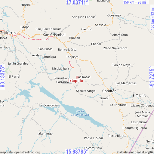
Ixtapilla GPS coordinates[2]
16° 21' 49.14" North, 92° 25' 50.232" West
| Map corner | latitude | longitude |
|---|---|---|
| Upper-left | 17.03711°, | -93.13375° |
| Center: | 16.36365°, | -92.43062° |
| Lower-right: | 15.68785°, | -91.7275° |
| Map W x H: | 150×150 km | = 93.2×93.2mi |
| max Lat: | 32.7° ⇑95.2% North |
| Ixtapilla: | 16.36365° |
| min Lat: | ⇓4.8% South 14.53588° |
| min Long | Ixtapilla | max Long |
| -117.105° | -92.43062° | -86.73105° |
| W 92.5%⇐ | ⇒7.5% E |
Elevation
Elevation of Ixtapilla is 1071 m = 3514 ft, and this is 182.7 m = 599 ft below average elevation for this country.
| Max E: |
3497 m = 11473 ft | 58.6% |
| Avg. | 1253.7 m = 4113 ft | |
| Ixtapilla | 1071 m = 3514 ft | |
Min E: |
-1 m = -3 ft | 41.4% |
See also: Mexico elevation on elevation.city.
Geographical zone
Ixtapilla is located in North Torrid zone (between Equator and Tropic of Cancer). Distance of this Northern Tropic circle is 786.5 km =488.7 mi to North.| Distance of | km | miles | from Ixtapilla |
|---|---|---|---|
| North Pole | 8187.6 | 5087.5 | to North |
| Arctic Circle | 5581.7 | 3468.3 | to North |
| Tropic Cancer | 786.5 | 488.7 | to North |
| Equator | 1819.5 | 1130.6 | to South |


Nearby cities:
15 places around Ixtapilla: (largest is in red/bold)
• Aguacatenango
12.5 km =7.8 mi,  10°
10°
• Corral Hierba
2.1 km =1.3 mi,  156°
156°
• El Puerto
6.9 km =4.3 mi,  0°
0°
• Grandeza del Río Blanco
7.8 km =4.8 mi,  286°
286°
• Guadalupe Palmira
16.4 km =10.2 mi,  55°
55°
• Guadalupe Victoria
13.8 km =8.6 mi, 289°
• La Gloria (La Tranca)
7.8 km =4.8 mi,  211°
211°
• Las Rosas
6.4 km =4 mi,  87°
87°
• San Francisco (El Calvito)
14.8 km =9.2 mi,  251°
251°
• San Francisco Pujiltic
9.7 km =6 mi,  194°
194°
• Socoltenango
15.7 km =9.8 mi,  147°
147°
• Soyatitán
7.7 km =4.8 mi,  174°
174°
• Tzinil
16.5 km =10.3 mi,  135°
135°
• Venustiano Carranza
14.4 km =8.9 mi,  258°
258°
• Zacualpa
8.5 km =5.3 mi, 141°
Sources, notices
• [Note1] Compared only with cities in Mexico existing in our database
• [Src1] Map data: © OpenStreetMap contributors (CC-BY-SA)
• [Src2] Other city data from geonames.org with taken over terms of usage.
• [Src3] Geographical zone / Annual Mean Temperature by Robert A. Rohde @ Wikipedia
