Pahuacán geodata
Pahuacán (State of Mexico) is a populated place; located in Mexico in America/Mexico_City (GMT-6) time zone. With population of 808 people, there are 10815 cities with bigger population in this country. Compared to other cities in Mexico, 63% of cities are located further ↑North; 53.5% of cities are located further ←West and 93.3% of cities have lower elevation than Pahuacán. Note1


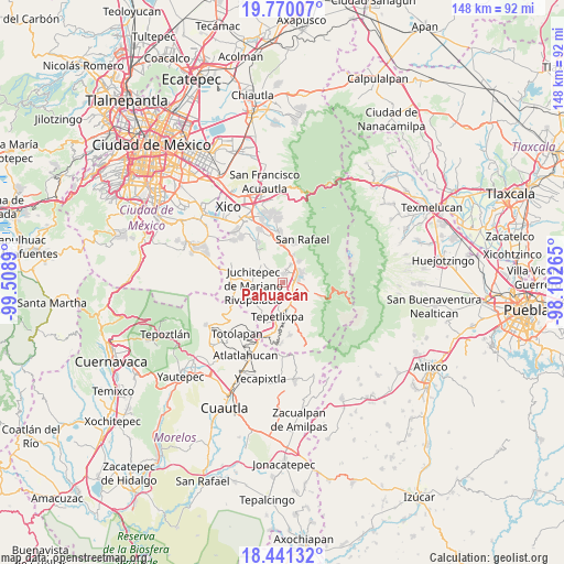
Pahuacán GPS coordinates[2]
19° 6' 25.308" North, 98° 48' 20.772" West
| Map corner | latitude | longitude |
|---|---|---|
| Upper-left | 19.77007°, | -99.5089° |
| Center: | 19.10703°, | -98.80577° |
| Lower-right: | 18.44132°, | -98.10265° |
| Map W x H: | 147.7×147.7 km | = 91.8×91.8mi |
| max Lat: | 32.7° ⇑63% North |
| Pahuacán: | 19.10703° |
| min Lat: | ⇓37% South 14.53588° |
| min Long | Pahuacán | max Long |
| -117.105° | -98.80577° | -86.73105° |
| W 53.5%⇐ | ⇒46.5% E |
Elevation
Elevation of Pahuacán is 2545 m = 8350 ft, and this is 1291.3 m = 4237 ft above average elevation for this country.
| Max E: |
3497 m = 11473 ft | 6.7% |
| Pahuacán | 2545 m 8350 ft | |
| Avg. | 1253.7 m = 4113 ft | |
Min E: |
-1 m = -3 ft | 93.3% |
See also: Mexico elevation on elevation.city.
Geographical zone
Pahuacán is located in North Torrid zone (between Equator and Tropic of Cancer). Distance of this Northern Tropic circle is 481.4 km =299.1 mi to North.| Distance of | km | miles | from Pahuacán |
|---|---|---|---|
| North Pole | 7882.6 | 4898 | to North |
| Arctic Circle | 5276.7 | 3278.8 | to North |
| Tropic Cancer | 481.4 | 299.1 | to North |
| Equator | 2124.5 | 1320.1 | to South |


Nearby cities:
15 places around Pahuacán: (largest is in red/bold)
• Amecameca
4.5 km =2.8 mi,  65°
65°
• Ayapango
2.3 km =1.4 mi,  15°
15°
• La Colonia
4.6 km =2.9 mi,  25°
25°
• Las Delicias
4.7 km =2.9 mi,  146°
146°
• Mihuacan
0.4 km =0.2 mi,  299°
299°
• Popo Park
5.3 km =3.3 mi, 150°
• Poxtla
3.5 km =2.2 mi,  13°
13°
• San Diego Chalcatepehuacán
3.4 km =2.1 mi,  54°
54°
• San Diego Huehuecalco
4.7 km =2.9 mi,  109°
109°
• San Juan Coxtocan
5.6 km =3.5 mi,  309°
309°
• San Mateo Tecalco
6.1 km =3.8 mi,  170°
170°
• San Matías Cuijingo
5.5 km =3.4 mi,  243°
243°
• Tlamapa
5 km =3.1 mi,  320°
320°
• Zentlalpan
5.3 km =3.3 mi, 24°
• Zoyatzingo
3 km =1.9 mi,  128°
128°
Sources, notices
• [Note1] Compared only with cities in Mexico existing in our database
• [Src1] Map data: © OpenStreetMap contributors (CC-BY-SA)
• [Src2] Other city data from geonames.org with taken over terms of usage.
• [Src3] Geographical zone / Annual Mean Temperature by Robert A. Rohde @ Wikipedia
