San Diego Chalcatepehuacán geodata
San Diego Chalcatepehuacán (State of Mexico) is a populated place; located in Mexico in America/Mexico_City (GMT-6) time zone. With population of 562 people, there are 15183 cities with bigger population in this country. Compared to other cities in Mexico, 62.6% of cities are located further ↑North; 53.9% of cities are located further ←West and 91.6% of cities have lower elevation than San Diego Chalcatepehuacán. Note1
Current local time in San Diego Chalcatepehuacán:
09:47 PM, TuesdayDifference from your time zone: hours


San Diego Chalcatepehuacán GPS coordinates[2]
19° 7' 30" North, 98° 46' 45.012" West
| Map corner | latitude | longitude |
|---|---|---|
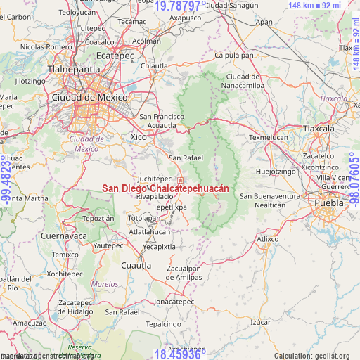
| Upper-left | 19.78797°, | -99.4823° |
| Center: | 19.125°, | -98.77917° |
| Lower-right: | 18.45936°, | -98.07605° |
| Map W x H: | 147.7×147.7 km | = 91.8×91.8mi |
| max Lat: | 32.7° ⇑62.6% North |
| San Diego Chalcatepehuacán: | 19.125° |
| min Lat: | ⇓37.4% South 14.53588° |
| min Long | San Diego Chalc | max Long |
| -117.105° | -98.77917° | -86.73105° |
| W 53.9%⇐ | ⇒46.1% E |
Elevation
Elevation of San Diego Chalcatepehuacán is 2464 m = 8084 ft, and this is 1210.3 m = 3971 ft above average elevation for this country.
| Max E: |
3497 m = 11473 ft | 8.4% |
| San Diego Chalcatepehuacán | 2464 m 8084 ft | |
| Avg. | 1253.7 m = 4113 ft | |
Min E: |
-1 m = -3 ft | 91.6% |
See also: Mexico elevation on elevation.city.
Geographical zone
San Diego Chalcatepehuacán is located in North Torrid zone (between Equator and Tropic of Cancer). Distance of this Northern Tropic circle is 479.4 km =297.9 mi to North.| Distance of | km | miles | from San Diego Chalcatepehuacán |
|---|---|---|---|
| North Pole | 7880.6 | 4896.8 | to North |
| Arctic Circle | 5274.7 | 3277.5 | to North |
| Tropic Cancer | 479.4 | 297.9 | to North |
| Equator | 2126.5 | 1321.3 | to South |


Nearby cities:
15 places around San Diego Chalcatepehuacán: (largest is in red/bold)
• Amecameca
1.3 km =0.8 mi,  95°
95°
• Ayapango
2.2 km =1.4 mi,  275°
275°
• La Colonia
2.3 km =1.4 mi,  339°
339°
• Las Delicias
5.9 km =3.7 mi,  181°
181°
• Mihuacan
3.6 km =2.2 mi,  239°
239°
• Pahuacán
3.4 km =2.1 mi,  234°
234°
• Poxtla
2.4 km =1.5 mi,  306°
306°
• San Antonio Tlaltecahuacán
3.8 km =2.4 mi,  16°
16°
• San Diego Huehuecalco
4 km =2.5 mi,  155°
155°
• Santa Isabel Chalma
3.9 km =2.4 mi, 22°
• Santiago Cuautenco
4.3 km =2.7 mi,  52°
52°
• Santo Tomás Atzingo
5.3 km =3.3 mi,  0°
0°
• Tlamapa
6.3 km =3.9 mi,  286°
286°
• Zentlalpan
2.8 km =1.7 mi,  347°
347°
• Zoyatzingo
3.9 km =2.4 mi,  186°
186°
Sources, notices
• [Note1] Compared only with cities in Mexico existing in our database
• [Src1] Map data: © OpenStreetMap contributors (CC-BY-SA)
• [Src2] Other city data from geonames.org with taken over terms of usage.
• [Src3] Geographical zone / Annual Mean Temperature by Robert A. Rohde @ Wikipedia
