San Sebastián de Juárez geodata
San Sebastián de Juárez (State of Mexico) is a populated place; located in Mexico in America/Mexico_City (GMT-6) time zone. With population of 536 people, there are 15820 cities with bigger population in this country. Compared to other cities in Mexico, 60.7% of cities are located further ↓South; 57.4% of cities are located further →East and 89.5% of cities have lower elevation than San Sebastián de Juárez. Note1
Current local time in San Sebastián de Juárez:
12:30 PM, MondayDifference from your time zone: hours


San Sebastián de Juárez GPS coordinates[2]
20° 10' 14.448" North, 99° 32' 4.02" West
| Map corner | latitude | longitude |
|---|---|---|
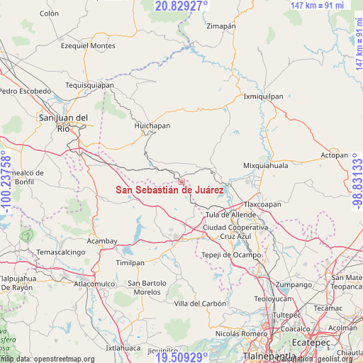
| Upper-left | 20.82927°, | -100.23758° |
| Center: | 20.17068°, | -99.53445° |
| Lower-right: | 19.50929°, | -98.83133° |
| Map W x H: | 146.8×146.8 km | = 91.2×91.2mi |
| max Lat: | 32.7° ⇑39.3% North |
| San Sebastián de Juárez: | 20.17068° |
| min Lat: | ⇓60.7% South 14.53588° |
| min Long | San Sebastián | max Long |
| -117.105° | -99.53445° | -86.73105° |
| W 42.6%⇐ | ⇒57.4% E |
Elevation
Elevation of San Sebastián de Juárez is 2387 m = 7831 ft, and this is 1133.3 m = 3718 ft above average elevation for this country.
| Max E: |
3497 m = 11473 ft | 10.5% |
| San Sebastián de Juárez | 2387 m 7831 ft | |
| Avg. | 1253.7 m = 4113 ft | |
Min E: |
-1 m = -3 ft | 89.5% |
See also: Mexico elevation on elevation.city.
Geographical zone
San Sebastián de Juárez is located in North Torrid zone (between Equator and Tropic of Cancer). Distance of this Northern Tropic circle is 363.1 km =225.6 mi to North.| Distance of | km | miles | from San Sebastián de Juárez |
|---|---|---|---|
| North Pole | 7764.3 | 4824.5 | to North |
| Arctic Circle | 5158.4 | 3205.3 | to North |
| Tropic Cancer | 363.1 | 225.6 | to North |
| Equator | 2242.8 | 1393.6 | to South |


Nearby cities:
15 places around San Sebastián de Juárez: (largest is in red/bold)
• El Jagüey
11.9 km =7.4 mi,  315°
315°
• Maravillas
6.6 km =4.1 mi,  304°
304°
• Pino Suárez
14.5 km =9 mi,  54°
54°
• San Bartolo Ozocalpan
7.5 km =4.7 mi,  38°
38°
• San José Deguedó
9.9 km =6.2 mi,  198°
198°
• San Juan Daxthi
8.1 km =5 mi,  173°
173°
• San Lorenzo Nenamicoyan
11.5 km =7.1 mi,  251°
251°
• San Martín Tuchicuitlapilco
14.5 km =9 mi,  233°
233°
• San Miguel de La Victoria
14 km =8.7 mi, 204°
• Santa Maria Amealco
7.6 km =4.7 mi,  348°
348°
• Santa Maria Macua
7.3 km =4.5 mi,  122°
122°
• Santiago Oxthoc
6.2 km =3.9 mi,  189°
189°
• Tecolapan
12.7 km =7.9 mi,  219°
219°
• Xiteje de la Reforma
6.1 km =3.8 mi, 121°
• Zimapantongo
11.2 km =7 mi, 47°
Sources, notices
• [Note1] Compared only with cities in Mexico existing in our database
• [Src1] Map data: © OpenStreetMap contributors (CC-BY-SA)
• [Src2] Other city data from geonames.org with taken over terms of usage.
• [Src3] Geographical zone / Annual Mean Temperature by Robert A. Rohde @ Wikipedia
