Santiago Oxthoc geodata
Santiago Oxthoc (Morelos) is a populated place; located in Mexico in America/Mexico_City (GMT-6) time zone. With population of 1,124 people, there are 7717 cities with bigger population in this country. Compared to other cities in Mexico, 59.5% of cities are located further ↓South; 57.5% of cities are located further →East and 89.7% of cities have lower elevation than Santiago Oxthoc. Note1


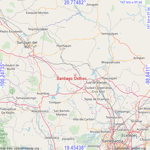
Santiago Oxthoc GPS coordinates[2]
20° 6' 57.564" North, 99° 32' 39.192" West
| Map corner | latitude | longitude |
|---|---|---|
| Upper-left | 20.77482°, | -100.24735° |
| Center: | 20.11599°, | -99.54422° |
| Lower-right: | 19.45438°, | -98.8411° |
| Map W x H: | 146.8×146.8 km | = 91.2×91.2mi |
| max Lat: | 32.7° ⇑40.5% North |
| Santiago Oxthoc: | 20.11599° |
| min Lat: | ⇓59.5% South 14.53588° |
| min Long | Santiago Oxthoc | max Long |
| -117.105° | -99.54422° | -86.73105° |
| W 42.5%⇐ | ⇒57.5% E |
Elevation
Elevation of Santiago Oxthoc is 2398 m = 7867 ft, and this is 1144.3 m = 3754 ft above average elevation for this country.
| Max E: |
3497 m = 11473 ft | 10.3% |
| Santiago Oxthoc | 2398 m 7867 ft | |
| Avg. | 1253.7 m = 4113 ft | |
Min E: |
-1 m = -3 ft | 89.7% |
See also: Mexico elevation on elevation.city.
Geographical zone
Santiago Oxthoc is located in North Torrid zone (between Equator and Tropic of Cancer). Distance of this Northern Tropic circle is 369.2 km =229.4 mi to North.| Distance of | km | miles | from Santiago Oxthoc |
|---|---|---|---|
| North Pole | 7770.4 | 4828.3 | to North |
| Arctic Circle | 5164.5 | 3209.1 | to North |
| Tropic Cancer | 369.2 | 229.4 | to North |
| Equator | 2236.7 | 1389.8 | to South |


Nearby cities:
15 places around Santiago Oxthoc: (largest is in red/bold)
• La Comunidad
11.1 km =6.9 mi,  197°
197°
• Maravillas
10.8 km =6.7 mi,  335°
335°
• San Agustín Buenavista
9.9 km =6.2 mi,  144°
144°
• San Bartolo Ozocalpan
13.3 km =8.3 mi,  25°
25°
• San José Deguedó
3.9 km =2.4 mi,  211°
211°
• San Juan Daxthi
2.7 km =1.7 mi, 135°
• San Lorenzo Nenamicoyan
10.1 km =6.3 mi,  283°
283°
• San Martín Tuchicuitlapilco
11 km =6.8 mi,  257°
257°
• San Miguel de La Victoria
8.3 km =5.2 mi,  216°
216°
• San Sebastián de Juárez
6.2 km =3.9 mi,  9°
9°
• San Vicente (Calpulalpan Tercera Manzana)
13.4 km =8.3 mi,  229°
229°
• Santa Maria Macua
7.5 km =4.7 mi,  72°
72°
• Soyaniquilpan
11.3 km =7 mi,  172°
172°
• Tecolapan
8 km =5 mi,  242°
242°
• Xiteje de la Reforma
6.8 km =4.2 mi,  64°
64°
Sources, notices
• [Note1] Compared only with cities in Mexico existing in our database
• [Src1] Map data: © OpenStreetMap contributors (CC-BY-SA)
• [Src2] Other city data from geonames.org with taken over terms of usage.
• [Src3] Geographical zone / Annual Mean Temperature by Robert A. Rohde @ Wikipedia
