San Miguel de La Victoria geodata
San Miguel de La Victoria (Morelos) is a populated place; located in Mexico in America/Mexico_City (GMT-6) time zone. With population of 3,238 people, there are 2798 cities with bigger population in this country. Compared to other cities in Mexico, 58.2% of cities are located further ↓South; 58.4% of cities are located further →East and 93.8% of cities have lower elevation than San Miguel de La Victoria. Note1
Current local time in San Miguel de La Victoria:
11:17 AM, MondayDifference from your time zone: hours


San Miguel de La Victoria GPS coordinates[2]
20° 3' 21.996" North, 99° 35' 27.924" West
| Map corner | latitude | longitude |
|---|---|---|
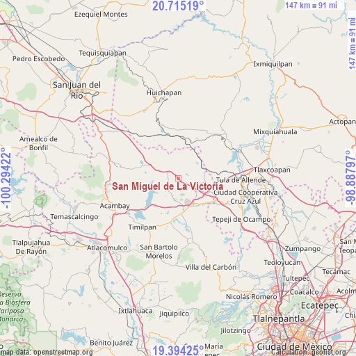
| Upper-left | 20.71519°, | -100.29422° |
| Center: | 20.05611°, | -99.59109° |
| Lower-right: | 19.39425°, | -98.88797° |
| Map W x H: | 146.9×146.9 km | = 91.3×91.3mi |
| max Lat: | 32.7° ⇑41.8% North |
| San Miguel de La Victoria: | 20.05611° |
| min Lat: | ⇓58.2% South 14.53588° |
| min Long | San Miguel de L | max Long |
| -117.105° | -99.59109° | -86.73105° |
| W 41.6%⇐ | ⇒58.4% E |
Elevation
Elevation of San Miguel de La Victoria is 2561 m = 8402 ft, and this is 1307.3 m = 4289 ft above average elevation for this country.
| Max E: |
3497 m = 11473 ft | 6.2% |
| San Miguel de La Victoria | 2561 m 8402 ft | |
| Avg. | 1253.7 m = 4113 ft | |
Min E: |
-1 m = -3 ft | 93.8% |
See also: Mexico elevation on elevation.city.
Geographical zone
San Miguel de La Victoria is located in North Torrid zone (between Equator and Tropic of Cancer). Distance of this Northern Tropic circle is 375.9 km =233.6 mi to North.| Distance of | km | miles | from San Miguel de La Victoria |
|---|---|---|---|
| North Pole | 7777 | 4832.4 | to North |
| Arctic Circle | 5171.1 | 3213.2 | to North |
| Tropic Cancer | 375.9 | 233.6 | to North |
| Equator | 2230 | 1385.7 | to South |


Nearby cities:
15 places around San Miguel de La Victoria: (largest is in red/bold)
• Agua Escondida
8.7 km =5.4 mi,  171°
171°
• Canalejas
8.7 km =5.4 mi,  189°
189°
• El Barrete
9.7 km =6 mi,  196°
196°
• El Saltillo
9.9 km =6.2 mi,  248°
248°
• La Comunidad
4.2 km =2.6 mi,  158°
158°
• Las Huertas
10 km =6.2 mi, 158°
• Octeyuco Dos Mil
10.3 km =6.4 mi,  178°
178°
• San José Deguedó
4.3 km =2.7 mi,  40°
40°
• San Juan Daxthi
8.3 km =5.2 mi,  55°
55°
• San Lorenzo Nenamicoyan
10.3 km =6.4 mi,  331°
331°
• San Martín Tuchicuitlapilco
7.2 km =4.5 mi,  305°
305°
• San Vicente (Calpulalpan Tercera Manzana)
5.7 km =3.5 mi, 248°
• Santiago Oxthoc
8.3 km =5.2 mi, 36°
• Soyaniquilpan
7.8 km =4.8 mi,  125°
125°
• Tecolapan
3.7 km =2.3 mi,  322°
322°
Sources, notices
• [Note1] Compared only with cities in Mexico existing in our database
• [Src1] Map data: © OpenStreetMap contributors (CC-BY-SA)
• [Src2] Other city data from geonames.org with taken over terms of usage.
• [Src3] Geographical zone / Annual Mean Temperature by Robert A. Rohde @ Wikipedia
