San José Deguedó geodata
San José Deguedó (State of Mexico) is a populated place; located in Mexico in America/Mexico_City (GMT-6) time zone. With population of 799 people, there are 10920 cities with bigger population in this country. Compared to other cities in Mexico, 58.8% of cities are located further ↓South; 57.8% of cities are located further →East and 92.8% of cities have lower elevation than San José Deguedó. Note1


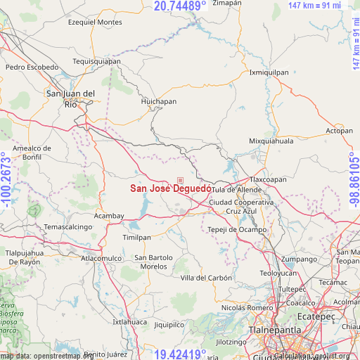
San José Deguedó GPS coordinates[2]
20° 5' 9.348" North, 99° 33' 51.012" West
| Map corner | latitude | longitude |
|---|---|---|
| Upper-left | 20.74489°, | -100.2673° |
| Center: | 20.08593°, | -99.56417° |
| Lower-right: | 19.42419°, | -98.86105° |
| Map W x H: | 146.8×146.8 km | = 91.2×91.2mi |
| max Lat: | 32.7° ⇑41.2% North |
| San José Deguedó: | 20.08593° |
| min Lat: | ⇓58.8% South 14.53588° |
| min Long | San José Degue | max Long |
| -117.105° | -99.56417° | -86.73105° |
| W 42.2%⇐ | ⇒57.8% E |
Elevation
Elevation of San José Deguedó is 2519 m = 8264 ft, and this is 1265.3 m = 4151 ft above average elevation for this country.
| Max E: |
3497 m = 11473 ft | 7.2% |
| San José Deguedó | 2519 m 8264 ft | |
| Avg. | 1253.7 m = 4113 ft | |
Min E: |
-1 m = -3 ft | 92.8% |
See also: Mexico elevation on elevation.city.
Geographical zone
San José Deguedó is located in North Torrid zone (between Equator and Tropic of Cancer). Distance of this Northern Tropic circle is 372.6 km =231.5 mi to North.| Distance of | km | miles | from San José Deguedó |
|---|---|---|---|
| North Pole | 7773.7 | 4830.4 | to North |
| Arctic Circle | 5167.8 | 3211.1 | to North |
| Tropic Cancer | 372.6 | 231.5 | to North |
| Equator | 2233.3 | 1387.7 | to South |


Nearby cities:
15 places around San José Deguedó: (largest is in red/bold)
• Agua Escondida
12 km =7.5 mi,  187°
187°
• La Comunidad
7.3 km =4.5 mi, 189°
• San Agustín Buenavista
9.1 km =5.7 mi,  121°
121°
• San Juan Daxthi
4.2 km =2.6 mi,  70°
70°
• San Lorenzo Nenamicoyan
9.6 km =6 mi,  306°
306°
• San Martín Tuchicuitlapilco
8.7 km =5.4 mi,  275°
275°
• San Miguel de La Victoria
4.3 km =2.7 mi,  220°
220°
• San Sebastián de Juárez
9.9 km =6.2 mi,  18°
18°
• San Vicente (Calpulalpan Tercera Manzana)
9.7 km =6 mi,  236°
236°
• Santa Maria Macua
10.8 km =6.7 mi,  58°
58°
• Santiago Oxthoc
3.9 km =2.4 mi,  31°
31°
• Soyaniquilpan
8.7 km =5.4 mi,  155°
155°
• Tecolapan
5.1 km =3.2 mi,  265°
265°
• Xhitey
12.2 km =7.6 mi, 161°
• Xiteje de la Reforma
10.4 km =6.5 mi,  52°
52°
Sources, notices
• [Note1] Compared only with cities in Mexico existing in our database
• [Src1] Map data: © OpenStreetMap contributors (CC-BY-SA)
• [Src2] Other city data from geonames.org with taken over terms of usage.
• [Src3] Geographical zone / Annual Mean Temperature by Robert A. Rohde @ Wikipedia
