Hernández geodata
Hernández (Puebla) is a populated place; located in Mexico in America/Mexico_City (GMT-6) time zone. With population of 661 people, there are 13143 cities with bigger population in this country. Compared to other cities in Mexico, 63.2% of cities are located further ↑North; 66.1% of cities are located further ←West and 88.3% of cities have lower elevation than Hernández. Note1


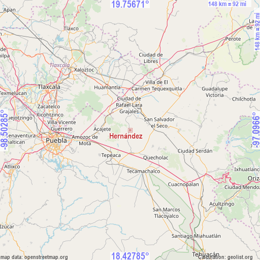
Hernández GPS coordinates[2]
19° 5' 36.996" North, 97° 47' 58.992" West
| Map corner | latitude | longitude |
|---|---|---|
| Upper-left | 19.75671°, | -98.50285° |
| Center: | 19.09361°, | -97.79972° |
| Lower-right: | 18.42785°, | -97.0966° |
| Map W x H: | 147.8×147.8 km | = 91.8×91.8mi |
| max Lat: | 32.7° ⇑63.2% North |
| Hernández: | 19.09361° |
| min Lat: | ⇓36.8% South 14.53588° |
| min Long | Hernández | max Long |
| -117.105° | -97.79972° | -86.73105° |
| W 66.1%⇐ | ⇒33.9% E |
Elevation
Elevation of Hernández is 2353 m = 7720 ft, and this is 1099.3 m = 3607 ft above average elevation for this country.
| Max E: |
3497 m = 11473 ft | 11.7% |
| Hernández | 2353 m 7720 ft | |
| Avg. | 1253.7 m = 4113 ft | |
Min E: |
-1 m = -3 ft | 88.3% |
See also: Mexico elevation on elevation.city.
Geographical zone
Hernández is located in North Torrid zone (between Equator and Tropic of Cancer). Distance of this Northern Tropic circle is 482.9 km =300.1 mi to North.| Distance of | km | miles | from Hernández |
|---|---|---|---|
| North Pole | 7884.1 | 4899 | to North |
| Arctic Circle | 5278.2 | 3279.7 | to North |
| Tropic Cancer | 482.9 | 300.1 | to North |
| Equator | 2123 | 1319.2 | to South |


Nearby cities:
15 places around Hernández: (largest is in red/bold)
• Carmen Serdán
6.5 km =4 mi,  191°
191°
• Colonia Benito Juárez
7 km =4.3 mi,  12°
12°
• Eréndira
7.5 km =4.7 mi,  28°
28°
• Guadalupe Morelos
7.6 km =4.7 mi,  183°
183°
• La Ermita
3.1 km =1.9 mi,  24°
24°
• Libertad Álvaro Obregón
5.7 km =3.5 mi,  36°
36°
• Los Reyes de Ocampo
6.3 km =3.9 mi,  221°
221°
• Manuel Ávila Camacho (La Cima)
4 km =2.5 mi,  342°
342°
• San Lorenzo Joya de Rodríguez
7.1 km =4.4 mi,  232°
232°
• San Mateo Soltepec
4.2 km =2.6 mi,  82°
82°
• San Miguel
6.5 km =4 mi,  244°
244°
• San Pedro la Joya
5.1 km =3.2 mi, 231°
• San Sebastián Teteles
6.9 km =4.3 mi,  171°
171°
• Santa Cuz del Bosque
5.7 km =3.5 mi,  322°
322°
• Vincente Guerrero
4.3 km =2.7 mi,  205°
205°
Sources, notices
• [Note1] Compared only with cities in Mexico existing in our database
• [Src1] Map data: © OpenStreetMap contributors (CC-BY-SA)
• [Src2] Other city data from geonames.org with taken over terms of usage.
• [Src3] Geographical zone / Annual Mean Temperature by Robert A. Rohde @ Wikipedia
