Vista Hermosa geodata
Vista Hermosa (Puebla) is a populated place; located in Mexico in America/Mexico_City (GMT-6) time zone. With population of 933 people, there are 9344 cities with bigger population in this country. Compared to other cities in Mexico, 62.8% of cities are located further ↑North; 66.9% of cities are located further ←West and 93% of cities have lower elevation than Vista Hermosa. Note1


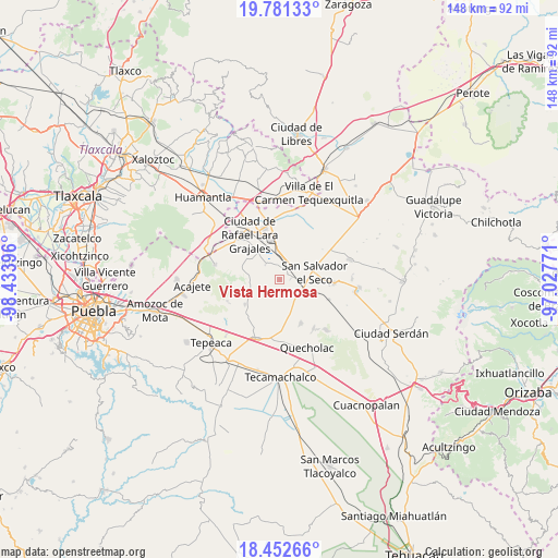
Vista Hermosa GPS coordinates[2]
19° 7' 5.988" North, 97° 43' 50.988" West
| Map corner | latitude | longitude |
|---|---|---|
| Upper-left | 19.78133°, | -98.43396° |
| Center: | 19.11833°, | -97.73083° |
| Lower-right: | 18.45266°, | -97.02771° |
| Map W x H: | 147.7×147.7 km | = 91.8×91.8mi |
| max Lat: | 32.7° ⇑62.8% North |
| Vista Hermosa: | 19.11833° |
| min Lat: | ⇓37.2% South 14.53588° |
| min Long | Vista Hermosa | max Long |
| -117.105° | -97.73083° | -86.73105° |
| W 66.9%⇐ | ⇒33.1% E |
Elevation
Elevation of Vista Hermosa is 2530 m = 8301 ft, and this is 1276.3 m = 4187 ft above average elevation for this country.
| Max E: |
3497 m = 11473 ft | 7% |
| Vista Hermosa | 2530 m 8301 ft | |
| Avg. | 1253.7 m = 4113 ft | |
Min E: |
-1 m = -3 ft | 93% |
See also: Mexico elevation on elevation.city.
Geographical zone
Vista Hermosa is located in North Torrid zone (between Equator and Tropic of Cancer). Distance of this Northern Tropic circle is 480.2 km =298.4 mi to North.| Distance of | km | miles | from Vista Hermosa |
|---|---|---|---|
| North Pole | 7881.3 | 4897.2 | to North |
| Arctic Circle | 5275.4 | 3278 | to North |
| Tropic Cancer | 480.2 | 298.4 | to North |
| Equator | 2125.8 | 1320.9 | to South |


Nearby cities:
15 places around Vista Hermosa: (largest is in red/bold)
• Candelaria Portezuelo
9.1 km =5.7 mi,  159°
159°
• Colonia Benito Juárez
7 km =4.3 mi,  305°
305°
• Eréndira
5.3 km =3.3 mi,  315°
315°
• Hernández
7.7 km =4.8 mi,  249°
249°
• La Ermita
6 km =3.7 mi,  270°
270°
• Libertad Álvaro Obregón
4.2 km =2.6 mi,  295°
295°
• Manuel Ávila Camacho (La Cima)
8.5 km =5.3 mi,  277°
277°
• Mazapiltepec
2.9 km =1.8 mi,  88°
88°
• San Martín Rinconada
6.8 km =4.2 mi, 86°
• San Mateo Soltepec
3.8 km =2.4 mi,  235°
235°
• San Salvador El Seco
9.5 km =5.9 mi,  79°
79°
• San Sebastián Villanueva
6.5 km =4 mi,  169°
169°
• Santa Cuz del Bosque
10.8 km =6.7 mi, 279°
• Soltepec
2.4 km =1.5 mi, 82°
• Vincente Guerrero
11.2 km =7 mi,  233°
233°
Sources, notices
• [Note1] Compared only with cities in Mexico existing in our database
• [Src1] Map data: © OpenStreetMap contributors (CC-BY-SA)
• [Src2] Other city data from geonames.org with taken over terms of usage.
• [Src3] Geographical zone / Annual Mean Temperature by Robert A. Rohde @ Wikipedia
