San Mateo Tlacoxcalco geodata
San Mateo Tlacoxcalco (Puebla) is a populated place; located in Mexico in America/Mexico_City (GMT-6) time zone. With population of 765 people, there are 11448 cities with bigger population in this country. Compared to other cities in Mexico, 75.1% of cities are located further ↑North; 71.3% of cities are located further ←West and 55.5% of cities have higher elevation than San Mateo Tlacoxcalco. Note1


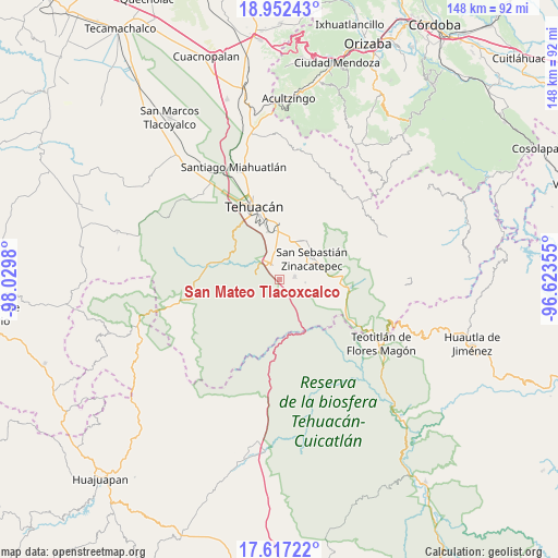
San Mateo Tlacoxcalco GPS coordinates[2]
18° 17' 9.996" North, 97° 19' 36.012" West
| Map corner | latitude | longitude |
|---|---|---|
| Upper-left | 18.95243°, | -98.0298° |
| Center: | 18.28611°, | -97.32667° |
| Lower-right: | 17.61722°, | -96.62355° |
| Map W x H: | 148.5×148.5 km | = 92.3×92.3mi |
| max Lat: | 32.7° ⇑75.1% North |
| San Mateo Tlacoxcalco: | 18.28611° |
| min Lat: | ⇓24.9% South 14.53588° |
| min Long | San Mateo Tlaco | max Long |
| -117.105° | -97.32667° | -86.73105° |
| W 71.3%⇐ | ⇒28.7% E |
Elevation
Elevation of San Mateo Tlacoxcalco is 1180 m = 3871 ft, and this is 73.7 m = 242 ft below average elevation for this country.
| Max E: |
3497 m = 11473 ft | 55.5% |
| Avg. | 1253.7 m = 4113 ft | |
| San Mateo Tlacoxcalco | 1180 m = 3871 ft | |
Min E: |
-1 m = -3 ft | 44.5% |
See also: Mexico elevation on elevation.city.
Geographical zone
San Mateo Tlacoxcalco is located in North Torrid zone (between Equator and Tropic of Cancer). Distance of this Northern Tropic circle is 572.7 km =355.9 mi to North.| Distance of | km | miles | from San Mateo Tlacoxcalco |
|---|---|---|---|
| North Pole | 7973.8 | 4954.7 | to North |
| Arctic Circle | 5367.9 | 3335.5 | to North |
| Tropic Cancer | 572.7 | 355.9 | to North |
| Equator | 2033.2 | 1263.4 | to South |


Nearby cities:
15 places around San Mateo Tlacoxcalco: (largest is in red/bold)
• Ajalpan
12.6 km =7.8 mi,  34°
34°
• Altepexi
9.8 km =6.1 mi,  16°
16°
• Axuxco
14 km =8.7 mi,  116°
116°
• Cinco de Mayo
15.3 km =9.5 mi, 23°
• Miahuatlán
4.1 km =2.5 mi,  81°
81°
• Necoxtla
12.9 km =8 mi,  344°
344°
• San Gabriel Chilac
4.9 km =3 mi,  334°
334°
• San Jerónimo Axochitlán
6.8 km =4.2 mi,  97°
97°
• San José Buena Vista
14.6 km =9.1 mi, 24°
• San Juan Atzingo
6.4 km =4 mi,  282°
282°
• San Miguel
14.1 km =8.8 mi,  358°
358°
• San Pedro Tetitlán
3 km =1.9 mi,  172°
172°
• Santa Cruz Acapa
13.3 km =8.3 mi,  0°
0°
• Tepetzingo
15.1 km =9.4 mi, 355°
• Zinacatepec
10.1 km =6.3 mi,  57°
57°
Sources, notices
• [Note1] Compared only with cities in Mexico existing in our database
• [Src1] Map data: © OpenStreetMap contributors (CC-BY-SA)
• [Src2] Other city data from geonames.org with taken over terms of usage.
• [Src3] Geographical zone / Annual Mean Temperature by Robert A. Rohde @ Wikipedia
