Jolalpan geodata
Jolalpan (Puebla) is a seat of a second-order administrative division; located in Mexico in America/Mexico_City (GMT-6) time zone. With population of 7,022 people, there are 1325 cities with bigger population in this country. Compared to other cities in Mexico, 74.6% of cities are located further ↑North; 52.9% of cities are located further ←West and 61.9% of cities have higher elevation than Jolalpan. Note1


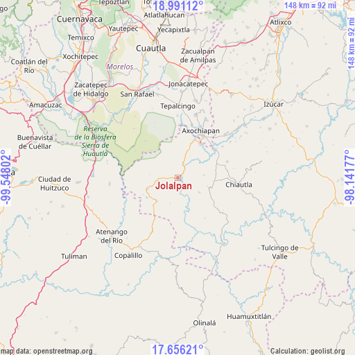
Jolalpan GPS coordinates[2]
18° 19' 29.82" North, 98° 50' 41.604" West
| Map corner | latitude | longitude |
|---|---|---|
| Upper-left | 18.99112°, | -99.54802° |
| Center: | 18.32495°, | -98.84489° |
| Lower-right: | 17.65621°, | -98.14177° |
| Map W x H: | 148.4×148.4 km | = 92.2×92.2mi |
| max Lat: | 32.7° ⇑74.6% North |
| Jolalpan: | 18.32495° |
| min Lat: | ⇓25.4% South 14.53588° |
| min Long | Jolalpan | max Long |
| -117.105° | -98.84489° | -86.73105° |
| W 52.9%⇐ | ⇒47.1% E |
Elevation
Elevation of Jolalpan is 883 m = 2897 ft, and this is 370.7 m = 1216 ft below average elevation for this country.
| Max E: |
3497 m = 11473 ft | 61.9% |
| Avg. | 1253.7 m = 4113 ft | |
| Jolalpan | 883 m = 2897 ft | |
Min E: |
-1 m = -3 ft | 38.1% |
See also: Mexico elevation on elevation.city.
Geographical zone
Jolalpan is located in North Torrid zone (between Equator and Tropic of Cancer). Distance of this Northern Tropic circle is 568.4 km =353.2 mi to North.| Distance of | km | miles | from Jolalpan |
|---|---|---|---|
| North Pole | 7969.5 | 4952 | to North |
| Arctic Circle | 5363.6 | 3332.8 | to North |
| Tropic Cancer | 568.4 | 353.2 | to North |
| Equator | 2037.5 | 1266 | to South |


Nearby cities:
15 places around Jolalpan: (largest is in red/bold)
• Axochiapan
22 km =13.7 mi,  26°
26°
• Ayoxuxtla
10.8 km =6.7 mi,  124°
124°
• Huachinantla
13.9 km =8.6 mi,  249°
249°
• Huautla
22.9 km =14.2 mi,  303°
303°
• Huehuetlan el Chico
17.2 km =10.7 mi,  71°
71°
• Pilcaya (San Juan Pilcaya)
17.5 km =10.9 mi, 123°
• Quebrantadero
22.9 km =14.2 mi,  14°
14°
• San Miguel Tecolacio
22.8 km =14.2 mi,  55°
55°
• Santa Ana Tecolapa
21.6 km =13.4 mi, 71°
• Santa Mónica
13.7 km =8.5 mi,  161°
161°
• Teotlalco
17.5 km =10.9 mi,  23°
23°
• Teutla
11.5 km =7.1 mi, 250°
• Tlancualpican
19.5 km =12.1 mi,  51°
51°
• Tzicatlán
16.9 km =10.5 mi, 33°
• Xochitepec
11.2 km =7 mi,  197°
197°
Sources, notices
• [Note1] Compared only with cities in Mexico existing in our database
• [Src1] Map data: © OpenStreetMap contributors (CC-BY-SA)
• [Src2] Other city data from geonames.org with taken over terms of usage.
• [Src3] Geographical zone / Annual Mean Temperature by Robert A. Rohde @ Wikipedia
