Santa Cruz geodata
Santa Cruz (Campeche) is a populated place; located in Mexico in America/Merida (GMT-6) time zone. With population of 1,118 people, there are 7770 cities with bigger population in this country. Compared to other cities in Mexico, 61.4% of cities are located further ↓South; 97.5% of cities are located further ←West and 97.5% of cities have higher elevation than Santa Cruz. Note1


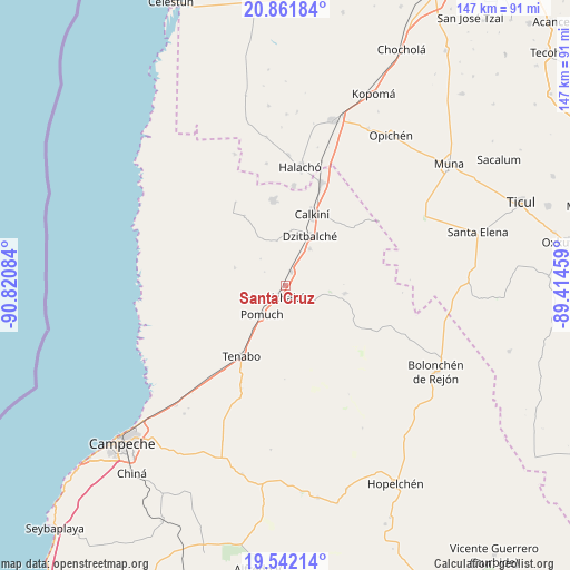
Santa Cruz GPS coordinates[2]
20° 12' 12.204" North, 90° 7' 3.756" West
| Map corner | latitude | longitude |
|---|---|---|
| Upper-left | 20.86184°, | -90.82084° |
| Center: | 20.20339°, | -90.11771° |
| Lower-right: | 19.54214°, | -89.41459° |
| Map W x H: | 146.7×146.7 km | = 91.2×91.2mi |
| max Lat: | 32.7° ⇑38.6% North |
| Santa Cruz: | 20.20339° |
| min Lat: | ⇓61.4% South 14.53588° |
| min Long | Santa Cruz | max Long |
| -117.105° | -90.11771° | -86.73105° |
| W 97.5%⇐ | ⇒2.5% E |
Elevation
Elevation of Santa Cruz is 9 m = 30 ft, and this is 1244.7 m = 4084 ft below average elevation for this country.
| Max E: |
3497 m = 11473 ft | 97.5% |
| Avg. | 1253.7 m = 4113 ft | |
| Santa Cruz | 9 m = 30 ft | |
Min E: |
-1 m = -3 ft | 2.5% |
See also: Mexico elevation on elevation.city.
Geographical zone
Santa Cruz is located in North Torrid zone (between Equator and Tropic of Cancer). Distance of this Northern Tropic circle is 359.5 km =223.4 mi to North.| Distance of | km | miles | from Santa Cruz |
|---|---|---|---|
| North Pole | 7760.7 | 4822.3 | to North |
| Arctic Circle | 5154.8 | 3203 | to North |
| Tropic Cancer | 359.5 | 223.4 | to North |
| Equator | 2246.4 | 1395.8 | to South |


Nearby cities:
15 places around Santa Cruz: (largest is in red/bold)
• Bacabchén
11.5 km =7.1 mi,  34°
34°
• Calkiní
19.7 km =12.2 mi,  20°
20°
• Chunkanán
13.7 km =8.5 mi,  289°
289°
• Cumpich
15.4 km =9.6 mi,  97°
97°
• Dzitbalché
14.3 km =8.9 mi, 26°
• Dzitnup
2.4 km =1.5 mi,  153°
153°
• Hecelchakán
3.3 km =2.1 mi,  209°
209°
• Nunkiní
22.1 km =13.7 mi,  351°
351°
• Pocboc
3.9 km =2.4 mi, 24°
• Pomuch
9.5 km =5.9 mi,  219°
219°
• Pucnachén
20.8 km =12.9 mi,  329°
329°
• San Antonio Sahcabchén
11.7 km =7.3 mi, 349°
• Santa Cruz Pueblo
14.6 km =9.1 mi,  5°
5°
• Tenabo
21.4 km =13.3 mi, 211°
• Tepakán
23 km =14.3 mi, 20°
Sources, notices
• [Note1] Compared only with cities in Mexico existing in our database
• [Src1] Map data: © OpenStreetMap contributors (CC-BY-SA)
• [Src2] Other city data from geonames.org with taken over terms of usage.
• [Src3] Geographical zone / Annual Mean Temperature by Robert A. Rohde @ Wikipedia
