Ich-Ek geodata
Ich-Ek (Campeche) is a populated place; located in Mexico in America/Merida (GMT-6) time zone. With population of 970 people, there are 8961 cities with bigger population in this country. Compared to other cities in Mexico, 51.2% of cities are located further ↓South; 97.6% of cities are located further ←West and 81% of cities have higher elevation than Ich-Ek. Note1


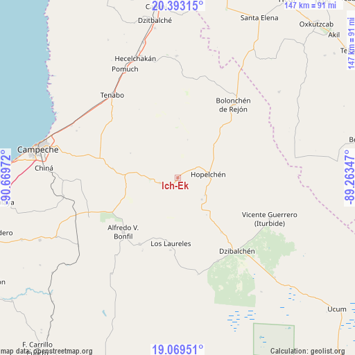
Ich-Ek GPS coordinates[2]
19° 43' 57.72" North, 89° 57' 59.724" West
| Map corner | latitude | longitude |
|---|---|---|
| Upper-left | 20.39315°, | -90.66972° |
| Center: | 19.7327°, | -89.96659° |
| Lower-right: | 19.06951°, | -89.26347° |
| Map W x H: | 147.2×147.2 km | = 91.5×91.5mi |
| max Lat: | 32.7° ⇑48.8% North |
| Ich-Ek: | 19.7327° |
| min Lat: | ⇓51.2% South 14.53588° |
| min Long | Ich-Ek | max Long |
| -117.105° | -89.96659° | -86.73105° |
| W 97.6%⇐ | ⇒2.4% E |
Elevation
Elevation of Ich-Ek is 82 m = 269 ft, and this is 1171.7 m = 3844 ft below average elevation for this country.
| Max E: |
3497 m = 11473 ft | 81% |
| Avg. | 1253.7 m = 4113 ft | |
| Ich-Ek | 82 m = 269 ft | |
Min E: |
-1 m = -3 ft | 19% |
See also: Mexico elevation on elevation.city.
Geographical zone
Ich-Ek is located in North Torrid zone (between Equator and Tropic of Cancer). Distance of this Northern Tropic circle is 411.8 km =255.9 mi to North.| Distance of | km | miles | from Ich-Ek |
|---|---|---|---|
| North Pole | 7813 | 4854.8 | to North |
| Arctic Circle | 5207.1 | 3235.5 | to North |
| Tropic Cancer | 411.8 | 255.9 | to North |
| Equator | 2194.1 | 1363.4 | to South |


Nearby cities:
15 places around Ich-Ek: (largest is in red/bold)
• Alfredo V. Bonfil
31.9 km =19.8 mi,  225°
225°
• Bolonchén de Rejón
37.9 km =23.5 mi,  37°
37°
• Crucero San Luis
4.5 km =2.8 mi,  213°
213°
• Dzibalchén
39.2 km =24.4 mi,  141°
141°
• Hopelchén
12.9 km =8 mi,  83°
83°
• Konchén
19.6 km =12.2 mi, 142°
• Los Laureles
27.4 km =17 mi,  186°
186°
• Nilchí
34.3 km =21.3 mi,  291°
291°
• Pich
31.7 km =19.7 mi, 209°
• Quetzal Edzná
33.8 km =21 mi, 205°
• Santa Rita
13.5 km =8.4 mi,  132°
132°
• Suc-Tuc
7.8 km =4.8 mi,  253°
253°
• Tikinmul
27.1 km =16.8 mi,  277°
277°
• Tinún
37.5 km =23.3 mi,  313°
313°
• Xcupil
13.4 km =8.3 mi,  123°
123°
Sources, notices
• [Note1] Compared only with cities in Mexico existing in our database
• [Src1] Map data: © OpenStreetMap contributors (CC-BY-SA)
• [Src2] Other city data from geonames.org with taken over terms of usage.
• [Src3] Geographical zone / Annual Mean Temperature by Robert A. Rohde @ Wikipedia
