Xcupil geodata
Xcupil (Campeche) is a populated place; located in Mexico in America/Merida (GMT-6) time zone. With population of 881 people, there are 9918 cities with bigger population in this country. Compared to other cities in Mexico, 50.5% of cities are located further ↑North; 97.7% of cities are located further ←West and 79.1% of cities have higher elevation than Xcupil. Note1


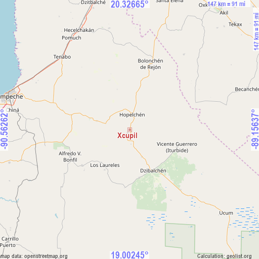
Xcupil GPS coordinates[2]
19° 39' 57.312" North, 89° 51' 34.164" West
| Map corner | latitude | longitude |
|---|---|---|
| Upper-left | 20.32665°, | -90.56262° |
| Center: | 19.66592°, | -89.85949° |
| Lower-right: | 19.00245°, | -89.15637° |
| Map W x H: | 147.2×147.2 km | = 91.5×91.5mi |
| max Lat: | 32.7° ⇑50.5% North |
| Xcupil: | 19.66592° |
| min Lat: | ⇓49.5% South 14.53588° |
| min Long | Xcupil | max Long |
| -117.105° | -89.85949° | -86.73105° |
| W 97.7%⇐ | ⇒2.3% E |
Elevation
Elevation of Xcupil is 109 m = 358 ft, and this is 1144.7 m = 3756 ft below average elevation for this country.
| Max E: |
3497 m = 11473 ft | 79.1% |
| Avg. | 1253.7 m = 4113 ft | |
| Xcupil | 109 m = 358 ft | |
Min E: |
-1 m = -3 ft | 20.9% |
See also: Mexico elevation on elevation.city.
Geographical zone
Xcupil is located in North Torrid zone (between Equator and Tropic of Cancer). Distance of this Northern Tropic circle is 419.3 km =260.5 mi to North.| Distance of | km | miles | from Xcupil |
|---|---|---|---|
| North Pole | 7820.4 | 4859.4 | to North |
| Arctic Circle | 5214.5 | 3240.1 | to North |
| Tropic Cancer | 419.3 | 260.5 | to North |
| Equator | 2186.6 | 1358.7 | to South |


Nearby cities:
15 places around Xcupil: (largest is in red/bold)
• Alfredo V. Bonfil
37 km =23 mi,  245°
245°
• Bolonchén de Rejón
39.4 km =24.5 mi,  17°
17°
• Chunchintok
44.6 km =27.7 mi,  139°
139°
• Crucero San Luis
14.2 km =8.8 mi,  285°
285°
• Dzibalchén
26.7 km =16.6 mi,  149°
149°
• Hopelchén
9.1 km =5.7 mi,  9°
9°
• Ich-Ek
13.4 km =8.3 mi,  303°
303°
• Iturbide
28.6 km =17.8 mi,  109°
109°
• Konchén
8.1 km =5 mi,  174°
174°
• Los Laureles
24.3 km =15.1 mi,  215°
215°
• Pich
33.7 km =20.9 mi,  233°
233°
• Quetzal Edzná
34.6 km =21.5 mi, 228°
• Santa Rita
2.1 km =1.3 mi, 215°
• Suc-Tuc
19.4 km =12.1 mi, 285°
• Tikinmul
39.7 km =24.7 mi, 286°
Sources, notices
• [Note1] Compared only with cities in Mexico existing in our database
• [Src1] Map data: © OpenStreetMap contributors (CC-BY-SA)
• [Src2] Other city data from geonames.org with taken over terms of usage.
• [Src3] Geographical zone / Annual Mean Temperature by Robert A. Rohde @ Wikipedia
