San Francisco Oxtutla geodata
San Francisco Oxtutla (Guerrero) is a populated place; located in Mexico in America/Mexico_City (GMT-6) time zone. With population of 1,393 people, there are 6206 cities with bigger population in this country. Compared to other cities in Mexico, 79.1% of cities are located further ↑North; 50.4% of cities are located further ←West and 66.4% of cities have higher elevation than San Francisco Oxtutla. Note1
Current local time in San Francisco Oxtutla:
08:32 AM, WednesdayDifference from your time zone: hours


San Francisco Oxtutla GPS coordinates[2]
17° 57' 42.192" North, 98° 59' 5.82" West
| Map corner | latitude | longitude |
|---|---|---|
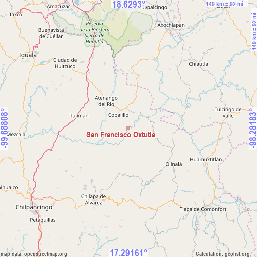
| Upper-left | 18.6293°, | -99.68808° |
| Center: | 17.96172°, | -98.98495° |
| Lower-right: | 17.29161°, | -98.28183° |
| Map W x H: | 148.7×148.7 km | = 92.4×92.4mi |
| max Lat: | 32.7° ⇑79.1% North |
| San Francisco Oxtutla: | 17.96172° |
| min Lat: | ⇓20.9% South 14.53588° |
| min Long | San Francisco O | max Long |
| -117.105° | -98.98495° | -86.73105° |
| W 50.4%⇐ | ⇒49.6% E |
Elevation
Elevation of San Francisco Oxtutla is 614 m = 2014 ft, and this is 639.7 m = 2099 ft below average elevation for this country.
| Max E: |
3497 m = 11473 ft | 66.4% |
| Avg. | 1253.7 m = 4113 ft | |
| San Francisco Oxtutla | 614 m = 2014 ft | |
Min E: |
-1 m = -3 ft | 33.6% |
See also: Mexico elevation on elevation.city.
Geographical zone
San Francisco Oxtutla is located in North Torrid zone (between Equator and Tropic of Cancer). Distance of this Northern Tropic circle is 608.8 km =378.3 mi to North.| Distance of | km | miles | from San Francisco Oxtutla |
|---|---|---|---|
| North Pole | 8009.9 | 4977.1 | to North |
| Arctic Circle | 5404 | 3357.9 | to North |
| Tropic Cancer | 608.8 | 378.3 | to North |
| Equator | 1997.2 | 1241 | to South |


Nearby cities:
15 places around San Francisco Oxtutla: (largest is in red/bold)
• Ajuatetla
22.1 km =13.7 mi,  205°
205°
• Atenango del Río
20.6 km =12.8 mi,  320°
320°
• Copalillo
10 km =6.2 mi, 323°
• El Cascalote
16.4 km =10.2 mi,  336°
336°
• Mezquitlán
8.4 km =5.2 mi,  38°
38°
• Mitlancingo
14.6 km =9.1 mi,  178°
178°
• Rincón de Cozahuapa
15.2 km =9.4 mi,  165°
165°
• San Juan (Las Joyas)
17.9 km =11.1 mi, 208°
• Tecolcuautla
19.9 km =12.4 mi, 168°
• Tecozajca (Tepehuaje)
20.3 km =12.6 mi,  143°
143°
• Temalac de Morelos
17.5 km =10.9 mi,  10°
10°
• Tepetlapa
22.9 km =14.2 mi,  297°
297°
• Tepetlatipa
17.8 km =11.1 mi,  193°
193°
• Tlalcozotitlán
17.7 km =11 mi,  240°
240°
• Zicapa
7.3 km =4.5 mi,  233°
233°
Sources, notices
• [Note1] Compared only with cities in Mexico existing in our database
• [Src1] Map data: © OpenStreetMap contributors (CC-BY-SA)
• [Src2] Other city data from geonames.org with taken over terms of usage.
• [Src3] Geographical zone / Annual Mean Temperature by Robert A. Rohde @ Wikipedia
