San Pedro Aytec geodata
San Pedro Aytec (Guerrero) is a populated place; located in Mexico in America/Mexico_City (GMT-6) time zone. With population of 752 people, there are 11651 cities with bigger population in this country. Compared to other cities in Mexico, 81.3% of cities are located further ↑North; 56.9% of cities are located further ←West and 60.7% of cities have higher elevation than San Pedro Aytec. Note1


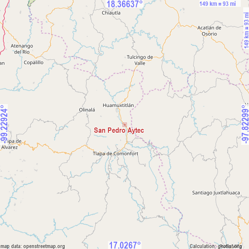
San Pedro Aytec GPS coordinates[2]
17° 41' 52.008" North, 98° 31' 33.996" West
| Map corner | latitude | longitude |
|---|---|---|
| Upper-left | 18.36637°, | -99.22924° |
| Center: | 17.69778°, | -98.52611° |
| Lower-right: | 17.0267°, | -97.82299° |
| Map W x H: | 149×149 km | = 92.6×92.6mi |
| max Lat: | 32.7° ⇑81.3% North |
| San Pedro Aytec: | 17.69778° |
| min Lat: | ⇓18.7% South 14.53588° |
| min Long | San Pedro Aytec | max Long |
| -117.105° | -98.52611° | -86.73105° |
| W 56.9%⇐ | ⇒43.1% E |
Elevation
Elevation of San Pedro Aytec is 958 m = 3143 ft, and this is 295.7 m = 970 ft below average elevation for this country.
| Max E: |
3497 m = 11473 ft | 60.7% |
| Avg. | 1253.7 m = 4113 ft | |
| San Pedro Aytec | 958 m = 3143 ft | |
Min E: |
-1 m = -3 ft | 39.3% |
See also: Mexico elevation on elevation.city.
Geographical zone
San Pedro Aytec is located in North Torrid zone (between Equator and Tropic of Cancer). Distance of this Northern Tropic circle is 638.1 km =396.5 mi to North.| Distance of | km | miles | from San Pedro Aytec |
|---|---|---|---|
| North Pole | 8039.3 | 4995.4 | to North |
| Arctic Circle | 5433.4 | 3376.2 | to North |
| Tropic Cancer | 638.1 | 396.5 | to North |
| Equator | 1967.8 | 1222.7 | to South |


Nearby cities:
15 places around San Pedro Aytec: (largest is in red/bold)
• Ahuatepec Pueblo
12.2 km =7.6 mi,  213°
213°
• Alpoyeca
3.5 km =2.2 mi,  150°
150°
• Chiepetlán (San Miguel Chiepetlán)
13.4 km =8.3 mi,  249°
249°
• Coatlaco
12 km =7.5 mi,  270°
270°
• Coyahualco
6.5 km =4 mi,  318°
318°
• Huamuxtitlán
12.5 km =7.8 mi,  341°
341°
• Ixcateopan
8.9 km =5.5 mi,  171°
171°
• San José Buenavista
2.7 km =1.7 mi,  179°
179°
• San Mateo Nejápam
12.5 km =7.8 mi,  111°
111°
• Santa Cruz
9.1 km =5.7 mi,  328°
328°
• Tecoyame de Guadalupe
11.3 km =7 mi,  136°
136°
• Tlalquetzala
1.6 km =1 mi,  304°
304°
• Tlaquiltepec
4.4 km =2.7 mi, 328°
• Tlatzala
9.5 km =5.9 mi,  195°
195°
• Zacualpan
8.6 km =5.3 mi, 251°
Sources, notices
• [Note1] Compared only with cities in Mexico existing in our database
• [Src1] Map data: © OpenStreetMap contributors (CC-BY-SA)
• [Src2] Other city data from geonames.org with taken over terms of usage.
• [Src3] Geographical zone / Annual Mean Temperature by Robert A. Rohde @ Wikipedia
