Tlaquiltepec geodata
Tlaquiltepec (Guerrero) is a populated place; located in Mexico in America/Mexico_City (GMT-6) time zone. With population of 1,307 people, there are 6636 cities with bigger population in this country. Compared to other cities in Mexico, 81.1% of cities are located further ↑North; 56.7% of cities are located further ←West and 61.1% of cities have higher elevation than Tlaquiltepec. Note1


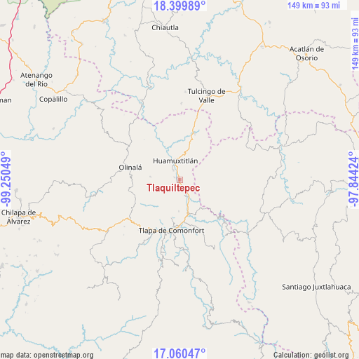
Tlaquiltepec GPS coordinates[2]
17° 43' 53.148" North, 98° 32' 50.496" West
| Map corner | latitude | longitude |
|---|---|---|
| Upper-left | 18.39989°, | -99.25049° |
| Center: | 17.73143°, | -98.54736° |
| Lower-right: | 17.06047°, | -97.84424° |
| Map W x H: | 148.9×148.9 km | = 92.5×92.5mi |
| max Lat: | 32.7° ⇑81.1% North |
| Tlaquiltepec: | 17.73143° |
| min Lat: | ⇓18.9% South 14.53588° |
| min Long | Tlaquiltepec | max Long |
| -117.105° | -98.54736° | -86.73105° |
| W 56.7%⇐ | ⇒43.3% E |
Elevation
Elevation of Tlaquiltepec is 931 m = 3054 ft, and this is 322.7 m = 1059 ft below average elevation for this country.
| Max E: |
3497 m = 11473 ft | 61.1% |
| Avg. | 1253.7 m = 4113 ft | |
| Tlaquiltepec | 931 m = 3054 ft | |
Min E: |
-1 m = -3 ft | 38.9% |
See also: Mexico elevation on elevation.city.
Geographical zone
Tlaquiltepec is located in North Torrid zone (between Equator and Tropic of Cancer). Distance of this Northern Tropic circle is 634.4 km =394.2 mi to North.| Distance of | km | miles | from Tlaquiltepec |
|---|---|---|---|
| North Pole | 8035.5 | 4993 | to North |
| Arctic Circle | 5429.6 | 3373.8 | to North |
| Tropic Cancer | 634.4 | 394.2 | to North |
| Equator | 1971.6 | 1225.1 | to South |


Nearby cities:
15 places around Tlaquiltepec: (largest is in red/bold)
• Ahuatepec Pueblo
14.7 km =9.1 mi,  197°
197°
• Alpoyeca
7.9 km =4.9 mi,  149°
149°
• Chiepetlán (San Miguel Chiepetlán)
13.3 km =8.3 mi,  230°
230°
• Coatlaco
10.3 km =6.4 mi,  249°
249°
• Coyahualco
2.3 km =1.4 mi,  298°
298°
• Cualác
12 km =7.5 mi,  276°
276°
• Huamuxtitlán
8.3 km =5.2 mi,  347°
347°
• Ixcateopan
13.1 km =8.1 mi,  164°
164°
• San José Buenavista
6.9 km =4.3 mi, 160°
• San Martín Jolalpan
12.8 km =8 mi,  265°
265°
• San Pedro Aytec
4.4 km =2.7 mi, 148°
• Santa Cruz
4.7 km =2.9 mi,  328°
328°
• Tlalquetzala
3 km =1.9 mi, 161°
• Tlatzala
13 km =8.1 mi,  181°
181°
• Zacualpan
8.7 km =5.4 mi,  222°
222°
Sources, notices
• [Note1] Compared only with cities in Mexico existing in our database
• [Src1] Map data: © OpenStreetMap contributors (CC-BY-SA)
• [Src2] Other city data from geonames.org with taken over terms of usage.
• [Src3] Geographical zone / Annual Mean Temperature by Robert A. Rohde @ Wikipedia
