Cochoapa el Grande geodata
Cochoapa el Grande (Guerrero) is a seat of a second-order administrative division; located in Mexico in America/Mexico_City (GMT-6) time zone. With population of 2,610 people, there are 3396 cities with bigger population in this country. Compared to other cities in Mexico, 86.7% of cities are located further ↑North; 57.8% of cities are located further ←West and 74.2% of cities have lower elevation than Cochoapa el Grande. Note1


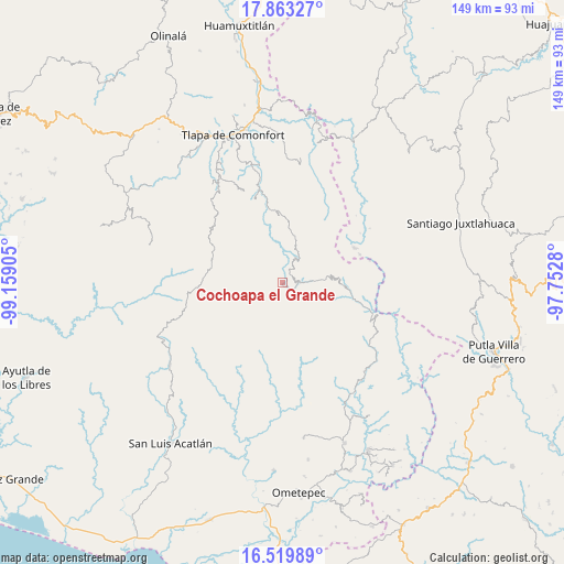
Cochoapa el Grande GPS coordinates[2]
17° 11' 34.08" North, 98° 27' 21.312" West
| Map corner | latitude | longitude |
|---|---|---|
| Upper-left | 17.86327°, | -99.15905° |
| Center: | 17.1928°, | -98.45592° |
| Lower-right: | 16.51989°, | -97.7528° |
| Map W x H: | 149.4×149.4 km | = 92.8×92.8mi |
| max Lat: | 32.7° ⇑86.7% North |
| Cochoapa el Grande: | 17.1928° |
| min Lat: | ⇓13.3% South 14.53588° |
| min Long | Cochoapa el Gra | max Long |
| -117.105° | -98.45592° | -86.73105° |
| W 57.8%⇐ | ⇒42.2% E |
Elevation
Elevation of Cochoapa el Grande is 2017 m = 6617 ft, and this is 763.3 m = 2504 ft above average elevation for this country.
| Max E: |
3497 m = 11473 ft | 25.8% |
| Cochoapa el Grande | 2017 m 6617 ft | |
| Avg. | 1253.7 m = 4113 ft | |
Min E: |
-1 m = -3 ft | 74.2% |
See also: Mexico elevation on elevation.city.
Geographical zone
Cochoapa el Grande is located in North Torrid zone (between Equator and Tropic of Cancer). Distance of this Northern Tropic circle is 694.3 km =431.4 mi to North.| Distance of | km | miles | from Cochoapa el Grande |
|---|---|---|---|
| North Pole | 8095.4 | 5030.2 | to North |
| Arctic Circle | 5489.5 | 3411 | to North |
| Tropic Cancer | 694.3 | 431.4 | to North |
| Equator | 1911.7 | 1187.9 | to South |


Nearby cities:
15 places around Cochoapa el Grande: (largest is in red/bold)
• Cocuilotlazala
12.4 km =7.7 mi,  14°
14°
• Francisco I. Madero
13.8 km =8.6 mi,  336°
336°
• Huehuetepec
16.6 km =10.3 mi,  300°
300°
• Huexoapa (San Juan Huexoapa)
7.8 km =4.8 mi,  34°
34°
• Joya Real
14.2 km =8.8 mi,  148°
148°
• Juanacatlán
16.1 km =10 mi, 338°
• Metlatónoc
5.2 km =3.2 mi,  87°
87°
• San Juan Puerto Montaña
11.8 km =7.3 mi,  324°
324°
• San Pablo Atzompa
10.9 km =6.8 mi,  56°
56°
• San Rafael
5.1 km =3.2 mi,  41°
41°
• San Vicente Zoyatlán
17.4 km =10.8 mi, 34°
• Santa Cruz
16.4 km =10.2 mi,  327°
327°
• Tierra Blanca
8.7 km =5.4 mi,  350°
350°
• Yuvinani
7 km =4.3 mi,  71°
71°
• Zilacayotitlán
15.1 km =9.4 mi, 318°
Sources, notices
• [Note1] Compared only with cities in Mexico existing in our database
• [Src1] Map data: © OpenStreetMap contributors (CC-BY-SA)
• [Src2] Other city data from geonames.org with taken over terms of usage.
• [Src3] Geographical zone / Annual Mean Temperature by Robert A. Rohde @ Wikipedia
