Juchitán geodata
Juchitán (Guerrero) is a seat of a second-order administrative division; located in Mexico in America/Mexico_City (GMT-6) time zone. With population of 3,346 people, there are 2716 cities with bigger population in this country. Compared to other cities in Mexico, 93.5% of cities are located further ↑North; 55.7% of cities are located further ←West and 78.4% of cities have higher elevation than Juchitán. Note1


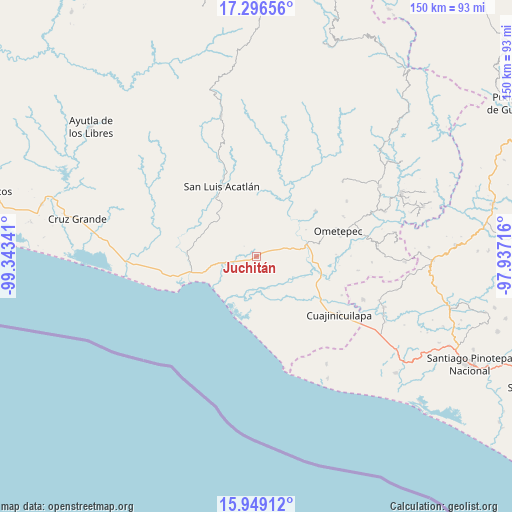
Juchitán GPS coordinates[2]
16° 37' 26.472" North, 98° 38' 25.008" West
| Map corner | latitude | longitude |
|---|---|---|
| Upper-left | 17.29656°, | -99.34341° |
| Center: | 16.62402°, | -98.64028° |
| Lower-right: | 15.94912°, | -97.93716° |
| Map W x H: | 149.8×149.8 km | = 93.1×93.1mi |
| max Lat: | 32.7° ⇑93.5% North |
| Juchitán: | 16.62402° |
| min Lat: | ⇓6.5% South 14.53588° |
| min Long | Juchitán | max Long |
| -117.105° | -98.64028° | -86.73105° |
| W 55.7%⇐ | ⇒44.3% E |
Elevation
Elevation of Juchitán is 123 m = 404 ft, and this is 1130.7 m = 3710 ft below average elevation for this country.
| Max E: |
3497 m = 11473 ft | 78.4% |
| Avg. | 1253.7 m = 4113 ft | |
| Juchitán | 123 m = 404 ft | |
Min E: |
-1 m = -3 ft | 21.6% |
See also: Mexico elevation on elevation.city.
Geographical zone
Juchitán is located in North Torrid zone (between Equator and Tropic of Cancer). Distance of this Northern Tropic circle is 757.5 km =470.7 mi to North.| Distance of | km | miles | from Juchitán |
|---|---|---|---|
| North Pole | 8158.6 | 5069.5 | to North |
| Arctic Circle | 5552.8 | 3450.3 | to North |
| Tropic Cancer | 757.5 | 470.7 | to North |
| Equator | 1848.4 | 1148.5 | to South |


Nearby cities:
15 places around Juchitán: (largest is in red/bold)
• Agua Zarca
6.6 km =4.1 mi,  269°
269°
• Arcelia de Rodríguez
12.5 km =7.8 mi,  357°
357°
• Azoyú
12.8 km =8 mi,  18°
18°
• Barra de Tecoanapa
16.1 km =10 mi,  217°
217°
• Carrizalillo
13.2 km =8.2 mi,  262°
262°
• Colonia Miguel Alemán Valdez
15.6 km =9.7 mi,  129°
129°
• El Capulín Chocolate
13.5 km =8.4 mi,  289°
289°
• El Pitahayo
15.7 km =9.8 mi, 130°
• Huehuetán
8.8 km =5.5 mi,  81°
81°
• Maldonado
15.9 km =9.9 mi,  167°
167°
• San Isidro el Puente (El Puente)
3.7 km =2.3 mi, 22°
• San Juan de los Llanos
15.4 km =9.6 mi, 76°
• Tenango
12.3 km =7.6 mi,  67°
67°
• Zapotitlán de la Fuente (El Zapote)
11.8 km =7.3 mi,  9°
9°
• Zoyatlán
13.7 km =8.5 mi,  313°
313°
Sources, notices
• [Note1] Compared only with cities in Mexico existing in our database
• [Src1] Map data: © OpenStreetMap contributors (CC-BY-SA)
• [Src2] Other city data from geonames.org with taken over terms of usage.
• [Src3] Geographical zone / Annual Mean Temperature by Robert A. Rohde @ Wikipedia
