Zapotitlán de la Fuente (El Zapote) geodata
Zapotitlán de la Fuente (El Zapote) (Guerrero) is a populated place; located in Mexico in America/Mexico_City (GMT-6) time zone. With population of 642 people, there are 13481 cities with bigger population in this country. Compared to other cities in Mexico, 92.5% of cities are located further ↑North; 55.8% of cities are located further ←West and 69.2% of cities have higher elevation than Zapotitlán de la Fuente (El Zapote). Note1
Current local time in Zapotitlán de la Fuente (El Zapote):
08:45 AM, MondayDifference from your time zone: hours


Zapotitlán de la Fuente (El Zapote) GPS coordinates[2]
16° 43' 41.988" North, 98° 37' 21" West
| Map corner | latitude | longitude |
|---|---|---|
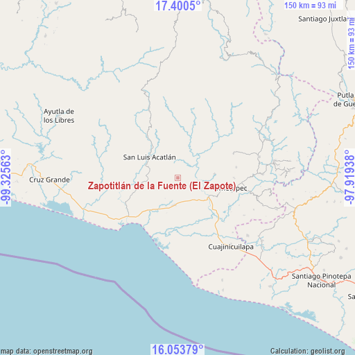
| Upper-left | 17.4005°, | -99.32563° |
| Center: | 16.72833°, | -98.6225° |
| Lower-right: | 16.05379°, | -97.91938° |
| Map W x H: | 149.7×149.7 km | = 93×93mi |
| max Lat: | 32.7° ⇑92.5% North |
| Zapotitlán de la Fuente (El Zapote): | 16.72833° |
| min Lat: | ⇓7.5% South 14.53588° |
| min Long | Zapotitlán de | max Long |
| -117.105° | -98.6225° | -86.73105° |
| W 55.8%⇐ | ⇒44.2% E |
Elevation
Elevation of Zapotitlán de la Fuente (El Zapote) is 458 m = 1503 ft, and this is 795.7 m = 2611 ft below average elevation for this country.
| Max E: |
3497 m = 11473 ft | 69.2% |
| Avg. | 1253.7 m = 4113 ft | |
| Zapotitlán de la Fuente (El Zapote) | 458 m = 1503 ft | |
Min E: |
-1 m = -3 ft | 30.8% |
See also: Mexico elevation on elevation.city.
Geographical zone
Zapotitlán de la Fuente (El Zapote) is located in North Torrid zone (between Equator and Tropic of Cancer). Distance of this Northern Tropic circle is 745.9 km =463.5 mi to North.| Distance of | km | miles | from Zapotitlán de la Fuente (El Zapote) |
|---|---|---|---|
| North Pole | 8147 | 5062.3 | to North |
| Arctic Circle | 5541.2 | 3443.1 | to North |
| Tropic Cancer | 745.9 | 463.5 | to North |
| Equator | 1860 | 1155.8 | to South |


Nearby cities:
15 places around Zapotitlán de la Fuente (El Zapote): (largest is in red/bold)
• Agua Zarca
14.4 km =8.9 mi,  216°
216°
• Arcelia de Rodríguez
2.6 km =1.6 mi,  291°
291°
• Azoyú
2.3 km =1.4 mi,  76°
76°
• Cuanacaxtitlán
8.1 km =5 mi,  346°
346°
• Huehuetán
12.3 km =7.6 mi,  146°
146°
• Jolotichán
11.8 km =7.3 mi,  282°
282°
• Juchitán
11.8 km =7.3 mi,  189°
189°
• Maxmadi
5.7 km =3.5 mi,  39°
39°
• Quetzalapa
14.2 km =8.8 mi,  63°
63°
• San Isidro el Puente (El Puente)
8.2 km =5.1 mi,  183°
183°
• San Juan de los Llanos
15.3 km =9.5 mi,  121°
121°
• San Luis Acatlán
14.8 km =9.2 mi,  307°
307°
• Tenango
11.7 km =7.3 mi,  126°
126°
• Yoloxóchitl
11.9 km =7.4 mi,  325°
325°
• Zoyatlán
12 km =7.5 mi,  259°
259°
Sources, notices
• [Note1] Compared only with cities in Mexico existing in our database
• [Src1] Map data: © OpenStreetMap contributors (CC-BY-SA)
• [Src2] Other city data from geonames.org with taken over terms of usage.
• [Src3] Geographical zone / Annual Mean Temperature by Robert A. Rohde @ Wikipedia
