Puerto Arturo geodata
Puerto Arturo (Quintana Roo) is a populated place; located in Mexico in America/Cancun (GMT-5) time zone. With population of 606 people, there are 14202 cities with bigger population in this country. Compared to other cities in Mexico, 50.7% of cities are located further ↑North; 98.7% of cities are located further ←West and 81.1% of cities have higher elevation than Puerto Arturo. Note1


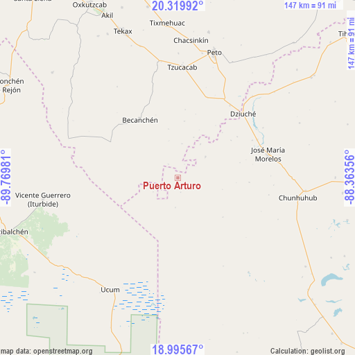
Puerto Arturo GPS coordinates[2]
19° 39' 32.976" North, 89° 4' 0.048" West
| Map corner | latitude | longitude |
|---|---|---|
| Upper-left | 20.31992°, | -89.76981° |
| Center: | 19.65916°, | -89.06668° |
| Lower-right: | 18.99567°, | -88.36356° |
| Map W x H: | 147.2×147.2 km | = 91.5×91.5mi |
| max Lat: | 32.7° ⇑50.7% North |
| Puerto Arturo: | 19.65916° |
| min Lat: | ⇓49.3% South 14.53588° |
| min Long | Puerto Arturo | max Long |
| -117.105° | -89.06668° | -86.73105° |
| W 98.7%⇐ | ⇒1.3% E |
Elevation
Elevation of Puerto Arturo is 80 m = 262 ft, and this is 1173.7 m = 3851 ft below average elevation for this country.
| Max E: |
3497 m = 11473 ft | 81.1% |
| Avg. | 1253.7 m = 4113 ft | |
| Puerto Arturo | 80 m = 262 ft | |
Min E: |
-1 m = -3 ft | 18.9% |
See also: Mexico elevation on elevation.city.
Geographical zone
Puerto Arturo is located in North Torrid zone (between Equator and Tropic of Cancer). Distance of this Northern Tropic circle is 420 km =261 mi to North.| Distance of | km | miles | from Puerto Arturo |
|---|---|---|---|
| North Pole | 7821.2 | 4859.9 | to North |
| Arctic Circle | 5215.3 | 3240.6 | to North |
| Tropic Cancer | 420 | 261 | to North |
| Equator | 2185.9 | 1358.3 | to South |


Nearby cities:
15 places around Puerto Arturo: (largest is in red/bold)
• Becanchén
28.7 km =17.8 mi,  326°
326°
• Bulukax
45.7 km =28.4 mi,  42°
42°
• Candelaria
14.2 km =8.8 mi,  52°
52°
• Catmis
35.3 km =21.9 mi,  20°
20°
• Chunhuhub
50.4 km =31.3 mi,  99°
99°
• Dziuche
37.8 km =23.5 mi, 45°
• El Naranjal
29.6 km =18.4 mi,  93°
93°
• José María Morelos
38.8 km =24.1 mi,  75°
75°
• Kancabchén
22.3 km =13.9 mi,  73°
73°
• La Presumida
36.3 km =22.6 mi,  64°
64°
• Othón P. Blanco
7.8 km =4.8 mi,  123°
123°
• San Diego
40.9 km =25.4 mi, 59°
• San Felipe Primero
29.8 km =18.5 mi, 55°
• Santa Gertrudis
34.6 km =21.5 mi, 63°
• Tzucacab
46 km =28.6 mi,  2°
2°
Sources, notices
• [Note1] Compared only with cities in Mexico existing in our database
• [Src1] Map data: © OpenStreetMap contributors (CC-BY-SA)
• [Src2] Other city data from geonames.org with taken over terms of usage.
• [Src3] Geographical zone / Annual Mean Temperature by Robert A. Rohde @ Wikipedia
