Candelaria geodata
Candelaria (Quintana Roo) is a populated place; located in Mexico in America/Cancun (GMT-5) time zone. With population of 963 people, there are 9035 cities with bigger population in this country. Compared to other cities in Mexico, 51.3% of cities are located further ↓South; 98.8% of cities are located further ←West and 83.8% of cities have higher elevation than Candelaria. Note1


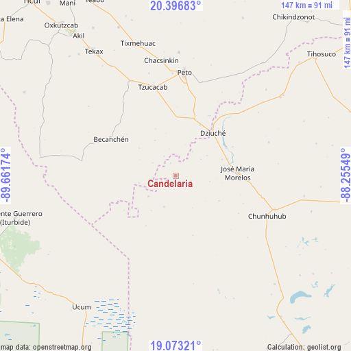
Candelaria GPS coordinates[2]
19° 44' 11.004" North, 88° 57' 30.996" West
| Map corner | latitude | longitude |
|---|---|---|
| Upper-left | 20.39683°, | -89.66174° |
| Center: | 19.73639°, | -88.95861° |
| Lower-right: | 19.07321°, | -88.25549° |
| Map W x H: | 147.2×147.2 km | = 91.5×91.5mi |
| max Lat: | 32.7° ⇑48.7% North |
| Candelaria: | 19.73639° |
| min Lat: | ⇓51.3% South 14.53588° |
| min Long | Candelaria | max Long |
| -117.105° | -88.95861° | -86.73105° |
| W 98.8%⇐ | ⇒1.2% E |
Elevation
Elevation of Candelaria is 53 m = 174 ft, and this is 1200.7 m = 3939 ft below average elevation for this country.
| Max E: |
3497 m = 11473 ft | 83.8% |
| Avg. | 1253.7 m = 4113 ft | |
| Candelaria | 53 m = 174 ft | |
Min E: |
-1 m = -3 ft | 16.2% |
See also: Mexico elevation on elevation.city.
Geographical zone
Candelaria is located in North Torrid zone (between Equator and Tropic of Cancer). Distance of this Northern Tropic circle is 411.4 km =255.6 mi to North.| Distance of | km | miles | from Candelaria |
|---|---|---|---|
| North Pole | 7812.6 | 4854.5 | to North |
| Arctic Circle | 5206.7 | 3235.3 | to North |
| Tropic Cancer | 411.4 | 255.6 | to North |
| Equator | 2194.5 | 1363.6 | to South |


Nearby cities:
15 places around Candelaria: (largest is in red/bold)
• Becanchén
31.1 km =19.3 mi,  299°
299°
• Bulukax
31.9 km =19.8 mi,  37°
37°
• Catmis
24.5 km =15.2 mi,  2°
2°
• Dziuche
23.7 km =14.7 mi, 41°
• El Naranjal
21 km =13 mi,  119°
119°
• José María Morelos
26.2 km =16.3 mi,  86°
86°
• Kancabchén
10.4 km =6.5 mi,  103°
103°
• La Esperanza
41.6 km =25.8 mi,  69°
69°
• La Presumida
22.6 km =14 mi, 71°
• Othón P. Blanco
13.8 km =8.6 mi,  200°
200°
• Puerto Arturo
14.2 km =8.8 mi,  232°
232°
• San Diego
26.9 km =16.7 mi,  63°
63°
• San Felipe Primero
15.7 km =9.8 mi, 57°
• Santa Gertrudis
20.7 km =12.9 mi, 70°
• Tzucacab
38.6 km =24 mi,  345°
345°
Sources, notices
• [Note1] Compared only with cities in Mexico existing in our database
• [Src1] Map data: © OpenStreetMap contributors (CC-BY-SA)
• [Src2] Other city data from geonames.org with taken over terms of usage.
• [Src3] Geographical zone / Annual Mean Temperature by Robert A. Rohde @ Wikipedia
