Nuevo Becar geodata
Nuevo Becar (Quintana Roo) is a populated place; located in Mexico in America/Cancun (GMT-5) time zone. With population of 557 people, there are 15314 cities with bigger population in this country. Compared to other cities in Mexico, 70% of cities are located further ↑North; 98.6% of cities are located further ←West and 77.8% of cities have higher elevation than Nuevo Becar. Note1


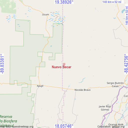
Nuevo Becar GPS coordinates[2]
18° 43' 28.812" North, 89° 7' 50.448" West
| Map corner | latitude | longitude |
|---|---|---|
| Upper-left | 19.38926°, | -89.83381° |
| Center: | 18.72467°, | -89.13068° |
| Lower-right: | 18.05746°, | -88.42756° |
| Map W x H: | 148.1×148.1 km | = 92×92mi |
| max Lat: | 32.7° ⇑70% North |
| Nuevo Becar: | 18.72467° |
| min Lat: | ⇓30% South 14.53588° |
| min Long | Nuevo Becar | max Long |
| -117.105° | -89.13068° | -86.73105° |
| W 98.6%⇐ | ⇒1.4% E |
Elevation
Elevation of Nuevo Becar is 136 m = 446 ft, and this is 1117.7 m = 3667 ft below average elevation for this country.
| Max E: |
3497 m = 11473 ft | 77.8% |
| Avg. | 1253.7 m = 4113 ft | |
| Nuevo Becar | 136 m = 446 ft | |
Min E: |
-1 m = -3 ft | 22.2% |
See also: Mexico elevation on elevation.city.
Geographical zone
Nuevo Becar is located in North Torrid zone (between Equator and Tropic of Cancer). Distance of this Northern Tropic circle is 523.9 km =325.5 mi to North.| Distance of | km | miles | from Nuevo Becar |
|---|---|---|---|
| North Pole | 7925.1 | 4924.4 | to North |
| Arctic Circle | 5319.2 | 3305.2 | to North |
| Tropic Cancer | 523.9 | 325.5 | to North |
| Equator | 2082 | 1293.7 | to South |


Nearby cities:
15 places around Nuevo Becar: (largest is in red/bold)
• Altos de Sevilla
49.8 km =30.9 mi,  73°
73°
• Caobas
31.2 km =19.4 mi,  175°
175°
• Francisco Villa
40.8 km =25.4 mi,  132°
132°
• Ingeniero Ricardo Payro Jene (Polo Norte)
56.2 km =34.9 mi,  216°
216°
• Jesús González Ortega
55.3 km =34.4 mi,  118°
118°
• Lázaro Cárdenas Segundo
28.8 km =17.9 mi,  95°
95°
• Manuel Castilla Brito
52.2 km =32.4 mi, 218°
• Miguel Alemán
21.4 km =13.3 mi,  10°
10°
• Morocoy
36.3 km =22.6 mi,  111°
111°
• Nachi Cocom
48.2 km =30 mi, 123°
• Nicolás Bravo
36.4 km =22.6 mi,  144°
144°
• San Pedro Peralta
29 km =18 mi, 95°
• San Román
43.1 km =26.8 mi,  79°
79°
• Xpujil
36.8 km =22.9 mi,  229°
229°
• Zoh-Laguna
33.5 km =20.8 mi,  244°
244°
Sources, notices
• [Note1] Compared only with cities in Mexico existing in our database
• [Src1] Map data: © OpenStreetMap contributors (CC-BY-SA)
• [Src2] Other city data from geonames.org with taken over terms of usage.
• [Src3] Geographical zone / Annual Mean Temperature by Robert A. Rohde @ Wikipedia
