Isla Holbox geodata
Isla Holbox (Quintana Roo) is a populated place; located in Mexico in America/Cancun (GMT-5) time zone. With population of 1,486 people, there are 5805 cities with bigger population in this country. Compared to other cities in Mexico, 81.6% of cities are located further ↓South; 99.9% of cities are located further ←West and 99.1% of cities have higher elevation than Isla Holbox. Note1


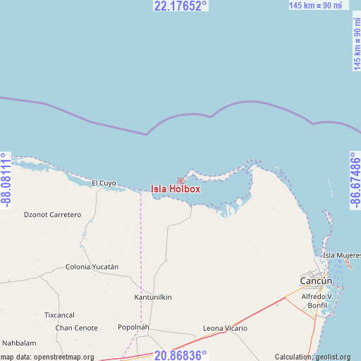
Isla Holbox GPS coordinates[2]
21° 31' 26.076" North, 87° 22' 40.728" West
| Map corner | latitude | longitude |
|---|---|---|
| Upper-left | 22.17652°, | -88.08111° |
| Center: | 21.52391°, | -87.37798° |
| Lower-right: | 20.86836°, | -86.67486° |
| Map W x H: | 145.5×145.5 km | = 90.4×90.4mi |
| max Lat: | 32.7° ⇑18.4% North |
| Isla Holbox: | 21.52391° |
| min Lat: | ⇓81.6% South 14.53588° |
| min Long | Isla Holbox | max Long |
| -117.105° | -87.37798° | -86.73105° |
| W 99.9%⇐ | ⇒0.099999999999994% E |
Elevation
Elevation of Isla Holbox is 6 m = 20 ft, and this is 1247.7 m = 4094 ft below average elevation for this country.
| Max E: |
3497 m = 11473 ft | 99.1% |
| Avg. | 1253.7 m = 4113 ft | |
| Isla Holbox | 6 m = 20 ft | |
Min E: |
-1 m = -3 ft | 0.9% |
See also: Mexico elevation on elevation.city.
Geographical zone
Isla Holbox is located in North Torrid zone (between Equator and Tropic of Cancer). Distance of this Northern Tropic circle is 212.7 km =132.2 mi to North.| Distance of | km | miles | from Isla Holbox |
|---|---|---|---|
| North Pole | 7613.8 | 4731 | to North |
| Arctic Circle | 5007.9 | 3111.8 | to North |
| Tropic Cancer | 212.7 | 132.2 | to North |
| Equator | 2393.2 | 1487.1 | to South |


Nearby cities:
15 places around Isla Holbox: (largest is in red/bold)
• Cancún
67.4 km =41.9 mi,  125°
125°
• Chiquilá
11 km =6.8 mi,  156°
156°
• Colonia Yucatán
49.8 km =30.9 mi,  226°
226°
• Dzonot Carretero
53.6 km =33.3 mi,  255°
255°
• El Cedral
66.2 km =41.1 mi,  195°
195°
• El Cuyo
31.1 km =19.3 mi,  268°
268°
• El Porvenir
63.1 km =39.2 mi,  141°
141°
• Kantunilkín
48.3 km =30 mi,  193°
193°
• Las Coloradas
64 km =39.8 mi,  278°
278°
• Leona Vicario
62.1 km =38.6 mi, 162°
• Popolnah
62 km =38.5 mi, 197°
• San Angel
32.6 km =20.3 mi, 189°
• Solferino
19.8 km =12.3 mi, 195°
• Vicente Guerrero
61.3 km =38.1 mi, 191°
• Zona Urbana Ejido Isla Mujeres
63.7 km =39.6 mi,  121°
121°
Sources, notices
• [Note1] Compared only with cities in Mexico existing in our database
• [Src1] Map data: © OpenStreetMap contributors (CC-BY-SA)
• [Src2] Other city data from geonames.org with taken over terms of usage.
• [Src3] Geographical zone / Annual Mean Temperature by Robert A. Rohde @ Wikipedia
