Paso Mulato geodata
Paso Mulato (Veracruz) is a populated place; located in Mexico in America/Mexico_City (GMT-6) time zone. With population of 525 people, there are 16085 cities with bigger population in this country. Compared to other cities in Mexico, 67.6% of cities are located further ↑North; 78.5% of cities are located further ←West and 72.2% of cities have higher elevation than Paso Mulato. Note1


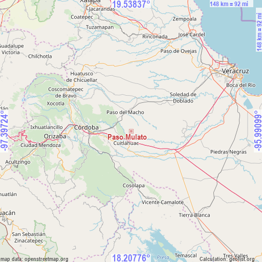
Paso Mulato GPS coordinates[2]
18° 52' 27.804" North, 96° 41' 38.796" West
| Map corner | latitude | longitude |
|---|---|---|
| Upper-left | 19.53837°, | -97.39724° |
| Center: | 18.87439°, | -96.69411° |
| Lower-right: | 18.20776°, | -95.99099° |
| Map W x H: | 147.9×148 km | = 91.9×92mi |
| max Lat: | 32.7° ⇑67.6% North |
| Paso Mulato: | 18.87439° |
| min Lat: | ⇓32.4% South 14.53588° |
| min Long | Paso Mulato | max Long |
| -117.105° | -96.69411° | -86.73105° |
| W 78.5%⇐ | ⇒21.5% E |
Elevation
Elevation of Paso Mulato is 320 m = 1050 ft, and this is 933.7 m = 3063 ft below average elevation for this country.
| Max E: |
3497 m = 11473 ft | 72.2% |
| Avg. | 1253.7 m = 4113 ft | |
| Paso Mulato | 320 m = 1050 ft | |
Min E: |
-1 m = -3 ft | 27.8% |
See also: Mexico elevation on elevation.city.
Geographical zone
Paso Mulato is located in North Torrid zone (between Equator and Tropic of Cancer). Distance of this Northern Tropic circle is 507.3 km =315.2 mi to North.| Distance of | km | miles | from Paso Mulato |
|---|---|---|---|
| North Pole | 7908.4 | 4914.1 | to North |
| Arctic Circle | 5302.5 | 3294.8 | to North |
| Tropic Cancer | 507.3 | 315.2 | to North |
| Equator | 2098.6 | 1304 | to South |


Nearby cities:
15 places around Paso Mulato: (largest is in red/bold)
• Arroyo Azul
5.8 km =3.6 mi,  169°
169°
• Atoyac
9.8 km =6.1 mi,  295°
295°
• Corral de Piedra
7.4 km =4.6 mi,  253°
253°
• Cuitláhuac
7.3 km =4.5 mi,  204°
204°
• División del Norte (Santa Rosa)
6 km =3.7 mi,  216°
216°
• El Maguey
6.3 km =3.9 mi, 222°
• El Palmar
8.5 km =5.3 mi,  159°
159°
• El Tamarindo
8.5 km =5.3 mi,  212°
212°
• Loma Angosta
10.3 km =6.4 mi, 169°
• Los Mangos
9.6 km =6 mi,  229°
229°
• Mata Gallina
10.2 km =6.3 mi,  125°
125°
• Salvador Esquer Apodaca [Unidad Habitacional]
9.6 km =6 mi,  343°
343°
• San Francisco (Mata Clara)
8.6 km =5.3 mi, 219°
• San Francisco de las Mesillas
10 km =6.2 mi,  240°
240°
• San José Balsa Camarón
6.9 km =4.3 mi,  350°
350°
Sources, notices
• [Note1] Compared only with cities in Mexico existing in our database
• [Src1] Map data: © OpenStreetMap contributors (CC-BY-SA)
• [Src2] Other city data from geonames.org with taken over terms of usage.
• [Src3] Geographical zone / Annual Mean Temperature by Robert A. Rohde @ Wikipedia
