Miguel Hidalgo geodata
Miguel Hidalgo (Puebla) is a populated place; located in Mexico in America/Mexico_City (GMT-6) time zone. With population of 1,212 people, there are 7183 cities with bigger population in this country. Compared to other cities in Mexico, 51.7% of cities are located further ↓South; 71.7% of cities are located further ←West and 77.2% of cities have lower elevation than Miguel Hidalgo. Note1


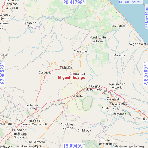
Miguel Hidalgo GPS coordinates[2]
19° 45' 27.504" North, 97° 16' 55.524" West
| Map corner | latitude | longitude |
|---|---|---|
| Upper-left | 20.41799°, | -97.98522° |
| Center: | 19.75764°, | -97.28209° |
| Lower-right: | 19.09455°, | -96.57897° |
| Map W x H: | 147.2×147.2 km | = 91.5×91.5mi |
| max Lat: | 32.7° ⇑48.3% North |
| Miguel Hidalgo: | 19.75764° |
| min Lat: | ⇓51.7% South 14.53588° |
| min Long | Miguel Hidalgo | max Long |
| -117.105° | -97.28209° | -86.73105° |
| W 71.7%⇐ | ⇒28.3% E |
Elevation
Elevation of Miguel Hidalgo is 2072 m = 6798 ft, and this is 818.3 m = 2685 ft above average elevation for this country.
| Max E: |
3497 m = 11473 ft | 22.8% |
| Miguel Hidalgo | 2072 m 6798 ft | |
| Avg. | 1253.7 m = 4113 ft | |
Min E: |
-1 m = -3 ft | 77.2% |
See also: Mexico elevation on elevation.city.
Geographical zone
Miguel Hidalgo is located in North Torrid zone (between Equator and Tropic of Cancer). Distance of this Northern Tropic circle is 409.1 km =254.2 mi to North.| Distance of | km | miles | from Miguel Hidalgo |
|---|---|---|---|
| North Pole | 7810.2 | 4853 | to North |
| Arctic Circle | 5204.3 | 3233.8 | to North |
| Tropic Cancer | 409.1 | 254.2 | to North |
| Equator | 2196.8 | 1365 | to South |


Nearby cities:
15 places around Miguel Hidalgo: (largest is in red/bold)
• Ahuacatán
3.3 km =2.1 mi,  330°
330°
• Ahueyahualco
4.8 km =3 mi,  151°
151°
• Altotonga
4 km =2.5 mi,  76°
76°
• Atzalan
5.4 km =3.4 mi,  50°
50°
• Calpulalpan
4.5 km =2.8 mi,  177°
177°
• Champilico
2.9 km =1.8 mi,  128°
128°
• Cuauhtamingo
3.4 km =2.1 mi,  283°
283°
• Loma de Hidalgo
1.8 km =1.1 mi,  231°
231°
• Ocotepec
5.6 km =3.5 mi,  8°
8°
• San Francisco
5.3 km =3.3 mi,  294°
294°
• Texacaxco
2.2 km =1.4 mi,  68°
68°
• Tomaquilapa
4.1 km =2.5 mi,  268°
268°
• Veintiuno de Agosto
3.8 km =2.4 mi,  164°
164°
• Xoampolco
5.5 km =3.4 mi,  86°
86°
• Zoatzingo
4.8 km =3 mi, 134°
Sources, notices
• [Note1] Compared only with cities in Mexico existing in our database
• [Src1] Map data: © OpenStreetMap contributors (CC-BY-SA)
• [Src2] Other city data from geonames.org with taken over terms of usage.
• [Src3] Geographical zone / Annual Mean Temperature by Robert A. Rohde @ Wikipedia
