Vicente Guerrero geodata
Vicente Guerrero (Veracruz) is a populated place; located in Mexico in America/Mexico_City (GMT-6) time zone. With population of 857 people, there are 10207 cities with bigger population in this country. Compared to other cities in Mexico, 54.3% of cities are located further ↓South; 76.1% of cities are located further ←West and 64% of cities have higher elevation than Vicente Guerrero. Note1


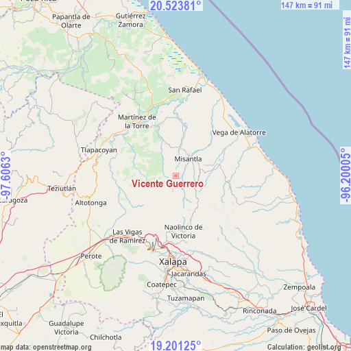
Vicente Guerrero GPS coordinates[2]
19° 51' 50.076" North, 96° 54' 11.412" West
| Map corner | latitude | longitude |
|---|---|---|
| Upper-left | 20.52381°, | -97.6063° |
| Center: | 19.86391°, | -96.90317° |
| Lower-right: | 19.20125°, | -96.20005° |
| Map W x H: | 147.1×147.1 km | = 91.4×91.4mi |
| max Lat: | 32.7° ⇑45.7% North |
| Vicente Guerrero: | 19.86391° |
| min Lat: | ⇓54.3% South 14.53588° |
| min Long | Vicente Guerrer | max Long |
| -117.105° | -96.90317° | -86.73105° |
| W 76.1%⇐ | ⇒23.9% E |
Elevation
Elevation of Vicente Guerrero is 753 m = 2470 ft, and this is 500.7 m = 1643 ft below average elevation for this country.
| Max E: |
3497 m = 11473 ft | 64% |
| Avg. | 1253.7 m = 4113 ft | |
| Vicente Guerrero | 753 m = 2470 ft | |
Min E: |
-1 m = -3 ft | 36% |
See also: Mexico elevation on elevation.city.
Geographical zone
Vicente Guerrero is located in North Torrid zone (between Equator and Tropic of Cancer). Distance of this Northern Tropic circle is 397.3 km =246.9 mi to North.| Distance of | km | miles | from Vicente Guerrero |
|---|---|---|---|
| North Pole | 7798.4 | 4845.7 | to North |
| Arctic Circle | 5192.5 | 3226.5 | to North |
| Tropic Cancer | 397.3 | 246.9 | to North |
| Equator | 2208.7 | 1372.4 | to South |


Nearby cities:
15 places around Vicente Guerrero: (largest is in red/bold)
• El Azotal
12.3 km =7.6 mi,  300°
300°
• Ignacio Zaragoza
14.1 km =8.8 mi,  342°
342°
• La Reforma (Kilómetro 9)
10.1 km =6.3 mi,  75°
75°
• Las Paredes
10.4 km =6.5 mi,  139°
139°
• Leona Vicario
10.8 km =6.7 mi,  95°
95°
• Manuel Gutiérrez Nájera
9 km =5.6 mi,  150°
150°
• Misantla
9.1 km =5.7 mi,  36°
36°
• Paso Blanco
3.2 km =2 mi, 81°
• Pueblo Viejo
6.2 km =3.9 mi, 150°
• Quilate Nuevo
8.5 km =5.3 mi,  278°
278°
• Salvador Díaz Mirón
9.2 km =5.7 mi,  160°
160°
• Santa Cruz Hidalgo
11.7 km =7.3 mi,  11°
11°
• Tenochtitlán
6.2 km =3.9 mi,  192°
192°
• Venustiano Carranza
10.8 km =6.7 mi,  64°
64°
• Yecuatla
13.1 km =8.1 mi,  88°
88°
Sources, notices
• [Note1] Compared only with cities in Mexico existing in our database
• [Src1] Map data: © OpenStreetMap contributors (CC-BY-SA)
• [Src2] Other city data from geonames.org with taken over terms of usage.
• [Src3] Geographical zone / Annual Mean Temperature by Robert A. Rohde @ Wikipedia
