Licenciado Gabriel Ramos Millán geodata
Licenciado Gabriel Ramos Millán (Veracruz) is a populated place; located in Mexico in America/Mexico_City (GMT-6) time zone. With population of 578 people, there are 14828 cities with bigger population in this country. Compared to other cities in Mexico, 82.2% of cities are located further ↑North; 85.1% of cities are located further ←West and 93.5% of cities have higher elevation than Licenciado Gabriel Ramos Millán. Note1
Current local time in Licenciado Gabriel Ramos Millán:
12:32 PM, MondayDifference from your time zone: hours


Licenciado Gabriel Ramos Millán GPS coordinates[2]
17° 35' 49.992" North, 94° 45' 0" West
| Map corner | latitude | longitude |
|---|---|---|
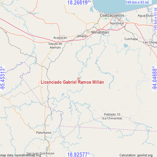
| Upper-left | 18.26619°, | -95.45313° |
| Center: | 17.59722°, | -94.75° |
| Lower-right: | 16.92577°, | -94.04688° |
| Map W x H: | 149×149 km | = 92.6×92.6mi |
| max Lat: | 32.7° ⇑82.2% North |
| Licenciado Gabriel Ramos Millán: | 17.59722° |
| min Lat: | ⇓17.8% South 14.53588° |
| min Long | Licenciado Gabr | max Long |
| -117.105° | -94.75° | -86.73105° |
| W 85.1%⇐ | ⇒14.9% E |
Elevation
Elevation of Licenciado Gabriel Ramos Millán is 16 m = 52 ft, and this is 1237.7 m = 4061 ft below average elevation for this country.
| Max E: |
3497 m = 11473 ft | 93.5% |
| Avg. | 1253.7 m = 4113 ft | |
| Licenciado Gabriel Ramos Millán | 16 m = 52 ft | |
Min E: |
-1 m = -3 ft | 6.5% |
See also: Mexico elevation on elevation.city.
Geographical zone
Licenciado Gabriel Ramos Millán is located in North Torrid zone (between Equator and Tropic of Cancer). Distance of this Northern Tropic circle is 649.3 km =403.5 mi to North.| Distance of | km | miles | from Licenciado Gabriel Ramos Millán |
|---|---|---|---|
| North Pole | 8050.4 | 5002.3 | to North |
| Arctic Circle | 5444.5 | 3383.1 | to North |
| Tropic Cancer | 649.3 | 403.5 | to North |
| Equator | 1956.6 | 1215.8 | to South |


Nearby cities:
15 places around Licenciado Gabriel Ramos Millán: (largest is in red/bold)
• Almagres
29.4 km =18.3 mi,  322°
322°
• Cahuapan (Anexo Niños Héroes)
26.4 km =16.4 mi,  127°
127°
• El Juile
30.2 km =18.8 mi,  302°
302°
• El Macayal
11.7 km =7.3 mi,  59°
59°
• El Súchil
30.8 km =19.1 mi,  252°
252°
• El Tepache
13.1 km =8.1 mi,  214°
214°
• Hidalgotitlán
22.1 km =13.7 mi,  29°
29°
• Las Lomas de Tacamichapan
30.2 km =18.8 mi,  8°
8°
• Medias Aguas
30.5 km =19 mi,  284°
284°
• Modelo Dos Ríos
22.4 km =13.9 mi,  184°
184°
• San Carlos
10.4 km =6.5 mi, 26°
• San Lorenzo Tenochtitlán
17.6 km =10.9 mi,  356°
356°
• Venustiano Carranza (Peña Blanca)
5 km =3.1 mi,  354°
354°
• Vicente Guerrero
11.7 km =7.3 mi,  163°
163°
• Villa Alta
0.6 km =0.4 mi, 302°
Sources, notices
• [Note1] Compared only with cities in Mexico existing in our database
• [Src1] Map data: © OpenStreetMap contributors (CC-BY-SA)
• [Src2] Other city data from geonames.org with taken over terms of usage.
• [Src3] Geographical zone / Annual Mean Temperature by Robert A. Rohde @ Wikipedia
