San Lorenzo Tenochtitlán geodata
San Lorenzo Tenochtitlán (Veracruz) is a populated place; located in Mexico in America/Mexico_City (GMT-6) time zone. With population of 1,037 people, there are 8413 cities with bigger population in this country. Compared to other cities in Mexico, 80.9% of cities are located further ↑North; 85.1% of cities are located further ←West and 90.8% of cities have higher elevation than San Lorenzo Tenochtitlán. Note1
Current local time in San Lorenzo Tenochtitlán:
11:21 AM, MondayDifference from your time zone: hours


San Lorenzo Tenochtitlán GPS coordinates[2]
17° 45' 18" North, 94° 45' 37.008" West
| Map corner | latitude | longitude |
|---|---|---|
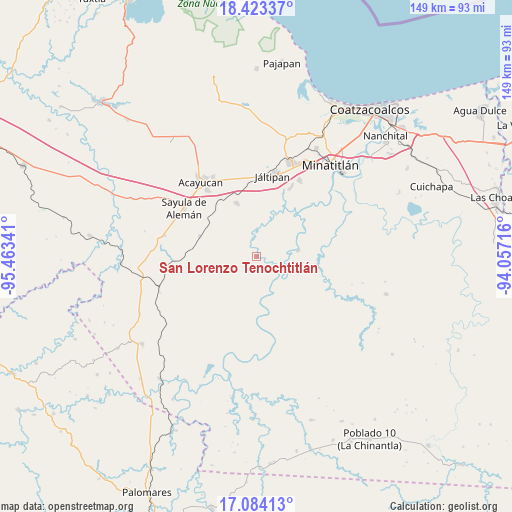
| Upper-left | 18.42337°, | -95.46341° |
| Center: | 17.755°, | -94.76028° |
| Lower-right: | 17.08413°, | -94.05716° |
| Map W x H: | 148.9×148.9 km | = 92.5×92.5mi |
| max Lat: | 32.7° ⇑80.9% North |
| San Lorenzo Tenochtitlán: | 17.755° |
| min Lat: | ⇓19.1% South 14.53588° |
| min Long | San Lorenzo Ten | max Long |
| -117.105° | -94.76028° | -86.73105° |
| W 85.1%⇐ | ⇒14.9% E |
Elevation
Elevation of San Lorenzo Tenochtitlán is 22 m = 72 ft, and this is 1231.7 m = 4041 ft below average elevation for this country.
| Max E: |
3497 m = 11473 ft | 90.8% |
| Avg. | 1253.7 m = 4113 ft | |
| San Lorenzo Tenochtitlán | 22 m = 72 ft | |
Min E: |
-1 m = -3 ft | 9.2% |
See also: Mexico elevation on elevation.city.
Geographical zone
San Lorenzo Tenochtitlán is located in North Torrid zone (between Equator and Tropic of Cancer). Distance of this Northern Tropic circle is 631.7 km =392.5 mi to North.| Distance of | km | miles | from San Lorenzo Tenochtitlán |
|---|---|---|---|
| North Pole | 8032.9 | 4991.4 | to North |
| Arctic Circle | 5427 | 3372.2 | to North |
| Tropic Cancer | 631.7 | 392.5 | to North |
| Equator | 1974.2 | 1226.7 | to South |


Nearby cities:
15 places around San Lorenzo Tenochtitlán: (largest is in red/bold)
• Almagres
17.6 km =10.9 mi,  289°
289°
• Coacotla
22.5 km =14 mi,  26°
26°
• El Macayal
16.1 km =10 mi,  135°
135°
• Emilio Carranza (Salinas)
22.2 km =13.8 mi,  75°
75°
• Hidalgotitlán
12.1 km =7.5 mi, 81°
• La Victoria
17.5 km =10.9 mi,  46°
46°
• Las Lomas de Tacamichapan
13.5 km =8.4 mi,  23°
23°
• Licenciado Gabriel Ramos Millán
17.6 km =10.9 mi,  176°
176°
• Limonta
21.7 km =13.5 mi,  44°
44°
• Monte Alto
21.3 km =13.2 mi, 41°
• San Carlos
10 km =6.2 mi,  145°
145°
• Tenejapa
19.2 km =11.9 mi,  323°
323°
• Texistepec
16.7 km =10.4 mi,  338°
338°
• Venustiano Carranza (Peña Blanca)
12.6 km =7.8 mi, 177°
• Villa Alta
17.2 km =10.7 mi, 178°
Sources, notices
• [Note1] Compared only with cities in Mexico existing in our database
• [Src1] Map data: © OpenStreetMap contributors (CC-BY-SA)
• [Src2] Other city data from geonames.org with taken over terms of usage.
• [Src3] Geographical zone / Annual Mean Temperature by Robert A. Rohde @ Wikipedia
