El Tepache geodata
El Tepache (Veracruz) is a populated place; located in Mexico in America/Mexico_City (GMT-6) time zone. With population of 615 people, there are 14017 cities with bigger population in this country. Compared to other cities in Mexico, 83.1% of cities are located further ↑North; 85% of cities are located further ←West and 88% of cities have higher elevation than El Tepache. Note1


El Tepache GPS coordinates[2]
17° 30' 0.576" North, 94° 49' 12.9" West
| Map corner | latitude | longitude |
|---|---|---|
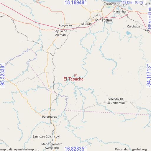
| Upper-left | 18.16949°, | -95.52338° |
| Center: | 17.50016°, | -94.82025° |
| Lower-right: | 16.82835°, | -94.11713° |
| Map W x H: | 149.1×149.1 km | = 92.6×92.6mi |
| max Lat: | 32.7° ⇑83.1% North |
| El Tepache: | 17.50016° |
| min Lat: | ⇓16.9% South 14.53588° |
| min Long | El Tepache | max Long |
| -117.105° | -94.82025° | -86.73105° |
| W 85%⇐ | ⇒15% E |
Elevation
Elevation of El Tepache is 30 m = 98 ft, and this is 1223.7 m = 4015 ft below average elevation for this country.
| Max E: |
3497 m = 11473 ft | 88% |
| Avg. | 1253.7 m = 4113 ft | |
| El Tepache | 30 m = 98 ft | |
Min E: |
-1 m = -3 ft | 12% |
See also: Mexico elevation on elevation.city.
Geographical zone
El Tepache is located in North Torrid zone (between Equator and Tropic of Cancer). Distance of this Northern Tropic circle is 660.1 km =410.2 mi to North.| Distance of | km | miles | from El Tepache |
|---|---|---|---|
| North Pole | 8061.2 | 5009 | to North |
| Arctic Circle | 5455.3 | 3389.8 | to North |
| Tropic Cancer | 660.1 | 410.2 | to North |
| Equator | 1945.8 | 1209.1 | to South |


Nearby cities:
15 places around El Tepache: (largest is in red/bold)
• Cahuapan (Anexo Niños Héroes)
28.9 km =18 mi,  100°
100°
• Coapiloloyita
21 km =13 mi,  246°
246°
• El Macayal
24.3 km =15.1 mi,  46°
46°
• El Súchil
21.9 km =13.6 mi,  273°
273°
• Jesús Carranza
23 km =14.3 mi, 251°
• Licenciado Gabriel Ramos Millán
13.1 km =8.1 mi,  34°
34°
• Modelo Dos Ríos
13 km =8.1 mi,  153°
153°
• Palo Dulce
28.4 km =17.6 mi,  255°
255°
• Plan de San Luis
28.1 km =17.5 mi,  217°
217°
• San Carlos
23.4 km =14.5 mi, 30°
• Suchilapan del Río
21.9 km =13.6 mi,  234°
234°
• Veinticuatro
28.7 km =17.8 mi,  180°
180°
• Venustiano Carranza (Peña Blanca)
17.3 km =10.7 mi,  23°
23°
• Vicente Guerrero
10.7 km =6.6 mi,  92°
92°
• Villa Alta
13.1 km =8.1 mi, 31°
Sources, notices
• [Note1] Compared only with cities in Mexico existing in our database
• [Src1] Map data: © OpenStreetMap contributors (CC-BY-SA)
• [Src2] Other city data from geonames.org with taken over terms of usage.
• [Src3] Geographical zone / Annual Mean Temperature by Robert A. Rohde @ Wikipedia
