Adalberto Tejeda geodata
Adalberto Tejeda (Veracruz) is a populated place; located in Mexico in America/Mexico_City (GMT-6) time zone. With population of 645 people, there are 13413 cities with bigger population in this country. Compared to other cities in Mexico, 82.4% of cities are located further ↑North; 85.7% of cities are located further ←West and 90.4% of cities have higher elevation than Adalberto Tejeda. Note1


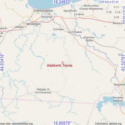
Adalberto Tejeda GPS coordinates[2]
17° 34' 49.08" North, 94° 13' 51.708" West
| Map corner | latitude | longitude |
|---|---|---|
| Upper-left | 18.24933°, | -94.93416° |
| Center: | 17.5803°, | -94.23103° |
| Lower-right: | 16.90879°, | -93.52791° |
| Map W x H: | 149.1×149.1 km | = 92.6×92.6mi |
| max Lat: | 32.7° ⇑82.4% North |
| Adalberto Tejeda: | 17.5803° |
| min Lat: | ⇓17.6% South 14.53588° |
| min Long | Adalberto Tejed | max Long |
| -117.105° | -94.23103° | -86.73105° |
| W 85.7%⇐ | ⇒14.3% E |
Elevation
Elevation of Adalberto Tejeda is 23 m = 75 ft, and this is 1230.7 m = 4038 ft below average elevation for this country.
| Max E: |
3497 m = 11473 ft | 90.4% |
| Avg. | 1253.7 m = 4113 ft | |
| Adalberto Tejeda | 23 m = 75 ft | |
Min E: |
-1 m = -3 ft | 9.6% |
See also: Mexico elevation on elevation.city.
Geographical zone
Adalberto Tejeda is located in North Torrid zone (between Equator and Tropic of Cancer). Distance of this Northern Tropic circle is 651.2 km =404.6 mi to North.| Distance of | km | miles | from Adalberto Tejeda |
|---|---|---|---|
| North Pole | 8052.3 | 5003.5 | to North |
| Arctic Circle | 5446.4 | 3384.2 | to North |
| Tropic Cancer | 651.2 | 404.6 | to North |
| Equator | 1954.7 | 1214.6 | to South |


Nearby cities:
15 places around Adalberto Tejeda: (largest is in red/bold)
• Cahuapan (Anexo Niños Héroes)
36.9 km =22.9 mi,  247°
247°
• Cuichapa
40.2 km =25 mi,  352°
352°
• Fernando López Arias
7.3 km =4.5 mi,  240°
240°
• Graciano Sánchez
35.9 km =22.3 mi,  103°
103°
• Gustavo Díaz Ordaz
15.6 km =9.7 mi,  318°
318°
• Helio García Alfaro
36.2 km =22.5 mi,  189°
189°
• La Breña
18.9 km =11.7 mi, 241°
• La Concepción
33.1 km =20.6 mi,  337°
337°
• Las Carolinas
35.4 km =22 mi,  217°
217°
• Las Choapas
39.5 km =24.5 mi,  21°
21°
• Niños Héroes
32.7 km =20.3 mi, 240°
• Nueva Esperanza
11.7 km =7.3 mi,  142°
142°
• Nueva Tabasqueña
25.4 km =15.8 mi, 104°
• Nuevo Atoyac
20.2 km =12.6 mi,  295°
295°
• San José del Carmen
35.7 km =22.2 mi,  25°
25°
Sources, notices
• [Note1] Compared only with cities in Mexico existing in our database
• [Src1] Map data: © OpenStreetMap contributors (CC-BY-SA)
• [Src2] Other city data from geonames.org with taken over terms of usage.
• [Src3] Geographical zone / Annual Mean Temperature by Robert A. Rohde @ Wikipedia
