Benito Juarez geodata
Benito Juarez (Mexico City) is a populated place; located in Mexico in America/Mexico_City (GMT-6) time zone. With population of 355,017 people, there are 56 cities with bigger population in this country. Compared to other cities in Mexico, 56.3% of cities are located further ↑North; 52% of cities are located further →East and 84% of cities have lower elevation than Benito Juarez. Note1


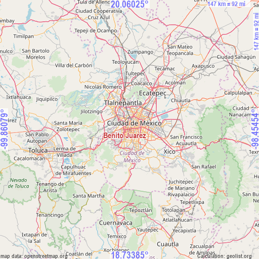
Benito Juarez GPS coordinates[2]
19° 23' 54.24" North, 99° 9' 27.576" West
| Map corner | latitude | longitude |
|---|---|---|
| Upper-left | 20.06025°, | -99.86079° |
| Center: | 19.3984°, | -99.15766° |
| Lower-right: | 18.73385°, | -98.45454° |
| Map W x H: | 147.5×147.5 km | = 91.7×91.7mi |
| max Lat: | 32.7° ⇑56.3% North |
| Benito Juarez: | 19.3984° |
| min Lat: | ⇓43.7% South 14.53588° |
| min Long | Benito Juarez | max Long |
| -117.105° | -99.15766° | -86.73105° |
| W 48%⇐ | ⇒52% E |
Elevation
Elevation of Benito Juarez is 2243 m = 7359 ft, and this is 989.3 m = 3246 ft above average elevation for this country.
| Max E: |
3497 m = 11473 ft | 16% |
| Benito Juarez | 2243 m 7359 ft | |
| Avg. | 1253.7 m = 4113 ft | |
Min E: |
-1 m = -3 ft | 84% |
See also: Benito Juarez elevation on elevation.city.
Geographical zone
Benito Juarez is located in North Torrid zone (between Equator and Tropic of Cancer). Distance of this Northern Tropic circle is 449 km =279 mi to North.| Distance of | km | miles | from Benito Juarez |
|---|---|---|---|
| North Pole | 7850.2 | 4877.9 | to North |
| Arctic Circle | 5244.3 | 3258.7 | to North |
| Tropic Cancer | 449 | 279 | to North |
| Equator | 2156.9 | 1340.2 | to South |


Nearby cities:
15 places around Benito Juarez: (largest is in red/bold)
• Azcapotzalco
10.3 km =6.4 mi,  343°
343°
• Benito Juárez
2.9 km =1.8 mi,  177°
177°
• Colonia Lindavista
10.9 km =6.8 mi,  18°
18°
• Colonia Nativitas
2.9 km =1.8 mi,  131°
131°
• Colonia del Valle
1.4 km =0.9 mi,  198°
198°
• Coyoacán
5.8 km =3.6 mi, 184°
• Cuauhtémoc
5.3 km =3.3 mi,  13°
13°
• Iztacalco
6.3 km =3.9 mi,  93°
93°
• Iztapalapa
11.1 km =6.9 mi,  115°
115°
• Magdalena Contreras
9.3 km =5.8 mi,  217°
217°
• Mexico City
4.6 km =2.9 mi,  43°
43°
• Miguel Hidalgo
6 km =3.7 mi,  311°
311°
• Polanco
5.8 km =3.6 mi, 311°
• Venustiano Carranza
7.5 km =4.7 mi,  47°
47°
• Álvaro Obregón
6.5 km =4 mi,  227°
227°
Sources, notices
• [Note1] Compared only with cities in Mexico existing in our database
• [Src1] Map data: © OpenStreetMap contributors (CC-BY-SA)
• [Src2] Other city data from geonames.org with taken over terms of usage.
• [Src3] Geographical zone / Annual Mean Temperature by Robert A. Rohde @ Wikipedia
