Venustiano Carranza geodata
Venustiano Carranza (Mexico City) is a section of populated place; located in Mexico in America/Mexico_City (GMT-6) time zone. With population of 430,978 people, there are 43 cities with bigger population in this country. Compared to other cities in Mexico, 55.2% of cities are located further ↑North; 51.2% of cities are located further →East and 83.6% of cities have lower elevation than Venustiano Carranza. Note1


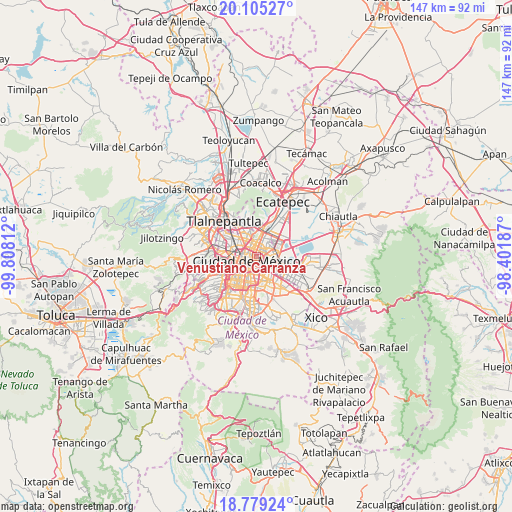
Venustiano Carranza GPS coordinates[2]
19° 26' 36.996" North, 99° 6' 17.964" West
| Map corner | latitude | longitude |
|---|---|---|
| Upper-left | 20.10527°, | -99.80812° |
| Center: | 19.44361°, | -99.10499° |
| Lower-right: | 18.77924°, | -98.40187° |
| Map W x H: | 147.4×147.4 km | = 91.6×91.6mi |
| max Lat: | 32.7° ⇑55.2% North |
| Venustiano Carranza: | 19.44361° |
| min Lat: | ⇓44.8% South 14.53588° |
| min Long | Venustiano Carr | max Long |
| -117.105° | -99.10499° | -86.73105° |
| W 48.8%⇐ | ⇒51.2% E |
Elevation
Elevation of Venustiano Carranza is 2235 m = 7333 ft, and this is 981.3 m = 3219 ft above average elevation for this country.
| Max E: |
3497 m = 11473 ft | 16.4% |
| Venustiano Carranza | 2235 m 7333 ft | |
| Avg. | 1253.7 m = 4113 ft | |
Min E: |
-1 m = -3 ft | 83.6% |
See also: Venustiano Carranza elevation on elevation.city.
Geographical zone
Venustiano Carranza is located in North Torrid zone (between Equator and Tropic of Cancer). Distance of this Northern Tropic circle is 444 km =275.9 mi to North.| Distance of | km | miles | from Venustiano Carranza |
|---|---|---|---|
| North Pole | 7845.1 | 4874.7 | to North |
| Arctic Circle | 5239.2 | 3255.5 | to North |
| Tropic Cancer | 444 | 275.9 | to North |
| Equator | 2161.9 | 1343.3 | to South |


Nearby cities:
15 places around Venustiano Carranza: (largest is in red/bold)
• Azcapotzalco
9.8 km =6.1 mi,  299°
299°
• Benito Juarez
7.5 km =4.7 mi,  227°
227°
• Benito Juárez
9.6 km =6 mi,  214°
214°
• Ciudad Nezahualcoyotl
10.6 km =6.6 mi,  116°
116°
• Colonia Gustavo Baz Prada
9.9 km =6.2 mi,  104°
104°
• Colonia Lindavista
5.7 km =3.5 mi,  338°
338°
• Colonia Nativitas
7.7 km =4.8 mi, 205°
• Colonia del Valle
8.8 km =5.5 mi,  223°
223°
• Cuauhtémoc
4.3 km =2.7 mi,  272°
272°
• Gustavo Adolfo Madero
5.6 km =3.5 mi,  353°
353°
• Iztacalco
5.4 km =3.4 mi,  171°
171°
• Iztapalapa
10.8 km =6.7 mi,  155°
155°
• Mexico City
2.9 km =1.8 mi, 234°
• Miguel Hidalgo
10 km =6.2 mi,  263°
263°
• Polanco
9.9 km =6.2 mi, 263°
Sources, notices
• [Note1] Compared only with cities in Mexico existing in our database
• [Src1] Map data: © OpenStreetMap contributors (CC-BY-SA)
• [Src2] Other city data from geonames.org with taken over terms of usage.
• [Src3] Geographical zone / Annual Mean Temperature by Robert A. Rohde @ Wikipedia
