Encarnación geodata
Encarnación (San Luis Potosí) is a populated place; located in Mexico in America/Mexico_City (GMT-6) time zone. With population of 522 people, there are 16162 cities with bigger population in this country. Compared to other cities in Mexico, 86.3% of cities are located further ↓South; 75.8% of cities are located further →East and 75.7% of cities have lower elevation than Encarnación. Note1


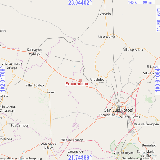
Encarnación GPS coordinates[2]
22° 23' 43.656" North, 101° 18' 50.256" West
| Map corner | latitude | longitude |
|---|---|---|
| Upper-left | 23.04402°, | -102.01709° |
| Center: | 22.39546°, | -101.31396° |
| Lower-right: | 21.74386°, | -100.61084° |
| Map W x H: | 144.6×144.6 km | = 89.9×89.9mi |
| max Lat: | 32.7° ⇑13.7% North |
| Encarnación: | 22.39546° |
| min Lat: | ⇓86.3% South 14.53588° |
| min Long | Encarnación | max Long |
| -117.105° | -101.31396° | -86.73105° |
| W 24.2%⇐ | ⇒75.8% E |
Elevation
Elevation of Encarnación is 2043 m = 6703 ft, and this is 789.3 m = 2590 ft above average elevation for this country.
| Max E: |
3497 m = 11473 ft | 24.3% |
| Encarnación | 2043 m 6703 ft | |
| Avg. | 1253.7 m = 4113 ft | |
Min E: |
-1 m = -3 ft | 75.7% |
See also: Mexico elevation on elevation.city.
Geographical zone
Encarnación is located in North Torrid zone (between Equator and Tropic of Cancer). Distance of this Northern Tropic circle is 115.8 km =72 mi to North.| Distance of | km | miles | from Encarnación |
|---|---|---|---|
| North Pole | 7516.9 | 4670.8 | to North |
| Arctic Circle | 4911 | 3051.6 | to North |
| Tropic Cancer | 115.8 | 72 | to North |
| Equator | 2490.1 | 1547.3 | to South |


Nearby cities:
15 places around Encarnación: (largest is in red/bold)
• Ahijaderos
16.5 km =10.3 mi,  260°
260°
• Ahualulco del Sonido Trece
15.2 km =9.4 mi,  88°
88°
• Barrancas
10.8 km =6.7 mi,  134°
134°
• Cerrito de Rojas
13.8 km =8.6 mi,  67°
67°
• El Carrizal
16.2 km =10.1 mi,  111°
111°
• Guadalupe de los Sauces
14.1 km =8.8 mi,  253°
253°
• Paso Bonito
9.5 km =5.9 mi,  145°
145°
• Ranchería de Guadalupe
14.4 km =8.9 mi, 126°
• Rincón del Porvenir
16.3 km =10.1 mi,  119°
119°
• Saldaña
8.9 km =5.5 mi,  272°
272°
• San Juan (San Juan de Coyotillos)
14.8 km =9.2 mi,  96°
96°
• Santa Ana
16.5 km =10.3 mi, 268°
• Santa Teresa
1.5 km =0.9 mi, 132°
• Santiago
16.3 km =10.1 mi,  293°
293°
• Tolosa
14.7 km =9.1 mi,  343°
343°
Sources, notices
• [Note1] Compared only with cities in Mexico existing in our database
• [Src1] Map data: © OpenStreetMap contributors (CC-BY-SA)
• [Src2] Other city data from geonames.org with taken over terms of usage.
• [Src3] Geographical zone / Annual Mean Temperature by Robert A. Rohde @ Wikipedia
