Ahijaderos geodata
Ahijaderos (Zacatecas) is a populated place; located in Mexico in America/Mexico_City (GMT-6) time zone. With population of 675 people, there are 12870 cities with bigger population in this country. Compared to other cities in Mexico, 86.1% of cities are located further ↓South; 77.2% of cities are located further →East and 83.5% of cities have lower elevation than Ahijaderos. Note1


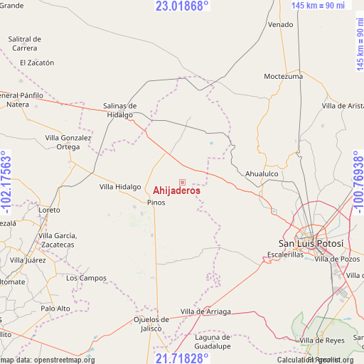
Ahijaderos GPS coordinates[2]
22° 22' 12" North, 101° 28' 21" West
| Map corner | latitude | longitude |
|---|---|---|
| Upper-left | 23.01868°, | -102.17563° |
| Center: | 22.37°, | -101.4725° |
| Lower-right: | 21.71828°, | -100.76938° |
| Map W x H: | 144.6×144.6 km | = 89.9×89.9mi |
| max Lat: | 32.7° ⇑13.9% North |
| Ahijaderos: | 22.37° |
| min Lat: | ⇓86.1% South 14.53588° |
| min Long | Ahijaderos | max Long |
| -117.105° | -101.4725° | -86.73105° |
| W 22.8%⇐ | ⇒77.2% E |
Elevation
Elevation of Ahijaderos is 2232 m = 7323 ft, and this is 978.3 m = 3210 ft above average elevation for this country.
| Max E: |
3497 m = 11473 ft | 16.5% |
| Ahijaderos | 2232 m 7323 ft | |
| Avg. | 1253.7 m = 4113 ft | |
Min E: |
-1 m = -3 ft | 83.5% |
See also: Mexico elevation on elevation.city.
Geographical zone
Ahijaderos is located in North Torrid zone (between Equator and Tropic of Cancer). Distance of this Northern Tropic circle is 118.6 km =73.7 mi to North.| Distance of | km | miles | from Ahijaderos |
|---|---|---|---|
| North Pole | 7519.8 | 4672.6 | to North |
| Arctic Circle | 4913.9 | 3053.4 | to North |
| Tropic Cancer | 118.6 | 73.7 | to North |
| Equator | 2487.3 | 1545.5 | to South |


Nearby cities:
15 places around Ahijaderos: (largest is in red/bold)
• Caballerías (Caballería Villa Hidalgo)
18.6 km =11.6 mi,  275°
275°
• Cieneguilla
19.2 km =11.9 mi,  166°
166°
• El Chino
20 km =12.4 mi,  253°
253°
• Encarnación
16.5 km =10.3 mi,  80°
80°
• Guadalupe de los Sauces
3.1 km =1.9 mi,  113°
113°
• La Pendencia
13 km =8.1 mi,  305°
305°
• La Victoria
20.5 km =12.7 mi,  232°
232°
• Pinos
13.5 km =8.4 mi, 232°
• Saldaña
8 km =5 mi,  66°
66°
• San Andrés
13.3 km =8.3 mi,  290°
290°
• San Martín
19.1 km =11.9 mi,  148°
148°
• Santa Ana
2.4 km =1.5 mi,  356°
356°
• Santa Teresa
17.5 km =10.9 mi, 84°
• Santiago
9.5 km =5.9 mi,  8°
8°
• Trinidad Norte
10.7 km =6.6 mi,  334°
334°
Sources, notices
• [Note1] Compared only with cities in Mexico existing in our database
• [Src1] Map data: © OpenStreetMap contributors (CC-BY-SA)
• [Src2] Other city data from geonames.org with taken over terms of usage.
• [Src3] Geographical zone / Annual Mean Temperature by Robert A. Rohde @ Wikipedia
