Peyote geodata
Peyote (San Luis Potosí) is a populated place; located in Mexico in America/Mexico_City (GMT-6) time zone. With population of 520 people, there are 16208 cities with bigger population in this country. Compared to other cities in Mexico, 87.2% of cities are located further ↓South; 70.3% of cities are located further →East and 52.1% of cities have lower elevation than Peyote. Note1


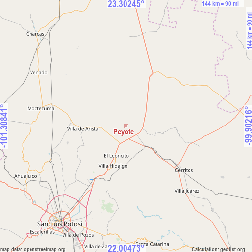
Peyote GPS coordinates[2]
22° 39' 18.432" North, 100° 36' 19.008" West
| Map corner | latitude | longitude |
|---|---|---|
| Upper-left | 23.30245°, | -101.30841° |
| Center: | 22.65512°, | -100.60528° |
| Lower-right: | 22.00473°, | -99.90216° |
| Map W x H: | 144.3×144.3 km | = 89.7×89.7mi |
| max Lat: | 32.7° ⇑12.8% North |
| Peyote: | 22.65512° |
| min Lat: | ⇓87.2% South 14.53588° |
| min Long | Peyote | max Long |
| -117.105° | -100.60528° | -86.73105° |
| W 29.7%⇐ | ⇒70.3% E |
Elevation
Elevation of Peyote is 1527 m = 5010 ft, and this is 273.3 m = 897 ft above average elevation for this country.
| Max E: |
3497 m = 11473 ft | 47.9% |
| Peyote | 1527 m 5010 ft | |
| Avg. | 1253.7 m = 4113 ft | |
Min E: |
-1 m = -3 ft | 52.1% |
See also: Mexico elevation on elevation.city.
Geographical zone
Peyote is located in North Torrid zone (between Equator and Tropic of Cancer). Distance of this Northern Tropic circle is 86.9 km =54 mi to North.| Distance of | km | miles | from Peyote |
|---|---|---|---|
| North Pole | 7488 | 4652.8 | to North |
| Arctic Circle | 4882.2 | 3033.7 | to North |
| Tropic Cancer | 86.9 | 54 | to North |
| Equator | 2519 | 1565.2 | to South |


Nearby cities:
15 places around Peyote: (largest is in red/bold)
• Abrego
23.7 km =14.7 mi,  94°
94°
• Charco Blanco
9.1 km =5.7 mi,  105°
105°
• El Charquito
9.5 km =5.9 mi,  251°
251°
• Guadalcázar
21.5 km =13.4 mi,  101°
101°
• La Redonda
24.2 km =15 mi,  191°
191°
• La Tapona
15.3 km =9.5 mi,  344°
344°
• Núñez
10.9 km =6.8 mi,  69°
69°
• Peotillos
17.9 km =11.1 mi,  181°
181°
• Pozas de Santa Ana
23 km =14.3 mi,  41°
41°
• Salitrillo
12.6 km =7.8 mi,  266°
266°
• San José del Arbolito
24.7 km =15.3 mi,  276°
276°
• San Lorenzo
11.5 km =7.1 mi,  202°
202°
• Veinte de Noviembre
26.9 km =16.7 mi, 186°
• Villa Hidalgo
24 km =14.9 mi, 198°
• Villa de Arista
25 km =15.5 mi, 266°
Sources, notices
• [Note1] Compared only with cities in Mexico existing in our database
• [Src1] Map data: © OpenStreetMap contributors (CC-BY-SA)
• [Src2] Other city data from geonames.org with taken over terms of usage.
• [Src3] Geographical zone / Annual Mean Temperature by Robert A. Rohde @ Wikipedia
