Zacán geodata
Zacán (Michoacán) is a populated place; located in Mexico in America/Mexico_City (GMT-6) time zone. With population of 773 people, there are 11306 cities with bigger population in this country. Compared to other cities in Mexico, 52.7% of cities are located further ↑North; 82.7% of cities are located further →East and 86.4% of cities have lower elevation than Zacán. Note1


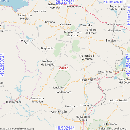
Zacán GPS coordinates[2]
19° 33' 57.636" North, 102° 17' 15.324" West
| Map corner | latitude | longitude |
|---|---|---|
| Upper-left | 20.22716°, | -102.99072° |
| Center: | 19.56601°, | -102.28759° |
| Lower-right: | 18.90214°, | -101.58447° |
| Map W x H: | 147.3×147.3 km | = 91.5×91.5mi |
| max Lat: | 32.7° ⇑52.7% North |
| Zacán: | 19.56601° |
| min Lat: | ⇓47.3% South 14.53588° |
| min Long | Zacán | max Long |
| -117.105° | -102.28759° | -86.73105° |
| W 17.3%⇐ | ⇒82.7% E |
Elevation
Elevation of Zacán is 2292 m = 7520 ft, and this is 1038.3 m = 3406 ft above average elevation for this country.
| Max E: |
3497 m = 11473 ft | 13.6% |
| Zacán | 2292 m 7520 ft | |
| Avg. | 1253.7 m = 4113 ft | |
Min E: |
-1 m = -3 ft | 86.4% |
See also: Mexico elevation on elevation.city.
Geographical zone
Zacán is located in North Torrid zone (between Equator and Tropic of Cancer). Distance of this Northern Tropic circle is 430.4 km =267.4 mi to North.| Distance of | km | miles | from Zacán |
|---|---|---|---|
| North Pole | 7831.5 | 4866.3 | to North |
| Arctic Circle | 5225.6 | 3247 | to North |
| Tropic Cancer | 430.4 | 267.4 | to North |
| Equator | 2175.5 | 1351.8 | to South |


Nearby cities:
15 places around Zacán: (largest is in red/bold)
• Angahuán
6.8 km =4.2 mi,  107°
107°
• Atapán
17.2 km =10.7 mi,  303°
303°
• Charapán
10.2 km =6.3 mi,  21°
21°
• Cherato
9.8 km =6.1 mi,  316°
316°
• Cocucho
17.6 km =10.9 mi,  35°
35°
• Corupo
7.3 km =4.5 mi,  49°
49°
• La Palma
6.6 km =4.1 mi,  309°
309°
• Nuevo Zirosto
6.6 km =4.1 mi,  252°
252°
• Pamatácuaro
15.3 km =9.5 mi,  336°
336°
• Peribán de Ramos
14.2 km =8.8 mi, 248°
• San Benito
16.1 km =10 mi,  347°
347°
• San Felipe de los Herreros
12.5 km =7.8 mi,  63°
63°
• San Francisco Peribán
11.7 km =7.3 mi,  264°
264°
• Santa Ana Zirosto
5.2 km =3.2 mi,  228°
228°
• Zicuicho
11.8 km =7.3 mi, 336°
Sources, notices
• [Note1] Compared only with cities in Mexico existing in our database
• [Src1] Map data: © OpenStreetMap contributors (CC-BY-SA)
• [Src2] Other city data from geonames.org with taken over terms of usage.
• [Src3] Geographical zone / Annual Mean Temperature by Robert A. Rohde @ Wikipedia
