Uricho geodata
Uricho (Michoacán) is a populated place; located in Mexico in America/Mexico_City (GMT-6) time zone. With population of 1,832 people, there are 4745 cities with bigger population in this country. Compared to other cities in Mexico, 52.6% of cities are located further ↑North; 79.2% of cities are located further →East and 76.5% of cities have lower elevation than Uricho. Note1


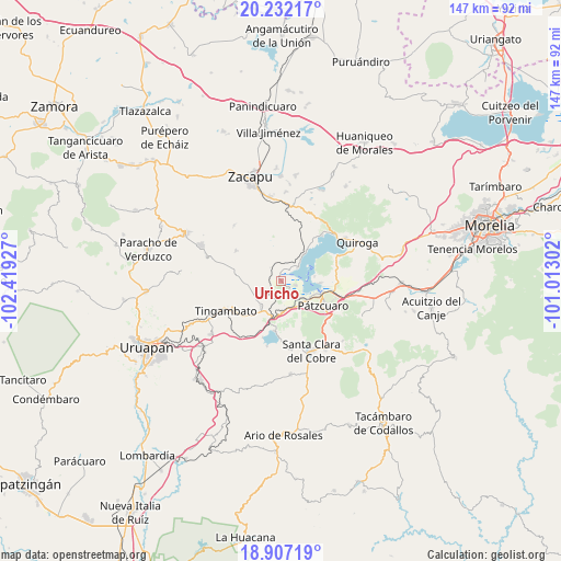
Uricho GPS coordinates[2]
19° 34' 15.744" North, 101° 42' 58.104" West
| Map corner | latitude | longitude |
|---|---|---|
| Upper-left | 20.23217°, | -102.41927° |
| Center: | 19.57104°, | -101.71614° |
| Lower-right: | 18.90719°, | -101.01302° |
| Map W x H: | 147.3×147.3 km | = 91.5×91.5mi |
| max Lat: | 32.7° ⇑52.6% North |
| Uricho: | 19.57104° |
| min Lat: | ⇓47.4% South 14.53588° |
| min Long | Uricho | max Long |
| -117.105° | -101.71614° | -86.73105° |
| W 20.8%⇐ | ⇒79.2% E |
Elevation
Elevation of Uricho is 2057 m = 6749 ft, and this is 803.3 m = 2635 ft above average elevation for this country.
| Max E: |
3497 m = 11473 ft | 23.5% |
| Uricho | 2057 m 6749 ft | |
| Avg. | 1253.7 m = 4113 ft | |
Min E: |
-1 m = -3 ft | 76.5% |
See also: Mexico elevation on elevation.city.
Geographical zone
Uricho is located in North Torrid zone (between Equator and Tropic of Cancer). Distance of this Northern Tropic circle is 429.8 km =267.1 mi to North.| Distance of | km | miles | from Uricho |
|---|---|---|---|
| North Pole | 7831 | 4866 | to North |
| Arctic Circle | 5225.1 | 3246.7 | to North |
| Tropic Cancer | 429.8 | 267.1 | to North |
| Equator | 2176.1 | 1352.2 | to South |


Nearby cities:
15 places around Uricho: (largest is in red/bold)
• Ajuno
6.5 km =4 mi,  186°
186°
• Arocutín
2.7 km =1.7 mi,  126°
126°
• Cucuchucho
9 km =5.6 mi,  81°
81°
• Erongarícuaro
2 km =1.2 mi,  345°
345°
• Huecorio
9.4 km =5.8 mi,  112°
112°
• Janitzio
6.7 km =4.2 mi,  87°
87°
• Jarácuaro
4.2 km =2.6 mi, 106°
• Napízaro
3.8 km =2.4 mi,  39°
39°
• Pichátaro
9.6 km =6 mi,  271°
271°
• Puácuaro
5.6 km =3.5 mi,  51°
51°
• San Miguel Nocutzepo
4.9 km =3 mi,  158°
158°
• San Pedro Pareo
6.4 km =4 mi, 131°
• Santa Ana Chapitiro
8.3 km =5.2 mi, 126°
• Santa María Huiramangaro (San Juan Tumbio)
8.3 km =5.2 mi,  218°
218°
• Tócuaro
4.2 km =2.6 mi,  147°
147°
Sources, notices
• [Note1] Compared only with cities in Mexico existing in our database
• [Src1] Map data: © OpenStreetMap contributors (CC-BY-SA)
• [Src2] Other city data from geonames.org with taken over terms of usage.
• [Src3] Geographical zone / Annual Mean Temperature by Robert A. Rohde @ Wikipedia
