Cucuchucho geodata
Cucuchucho (Michoacán) is a populated place; located in Mexico in America/Mexico_City (GMT-6) time zone. With population of 1,302 people, there are 6663 cities with bigger population in this country. Compared to other cities in Mexico, 52.3% of cities are located further ↑North; 78.4% of cities are located further →East and 76.6% of cities have lower elevation than Cucuchucho. Note1


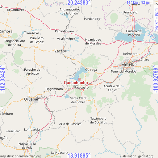
Cucuchucho GPS coordinates[2]
19° 34' 57.9" North, 101° 37' 51.996" West
| Map corner | latitude | longitude |
|---|---|---|
| Upper-left | 20.24383°, | -102.33424° |
| Center: | 19.58275°, | -101.63111° |
| Lower-right: | 18.91895°, | -100.92799° |
| Map W x H: | 147.3×147.3 km | = 91.5×91.5mi |
| max Lat: | 32.7° ⇑52.3% North |
| Cucuchucho: | 19.58275° |
| min Lat: | ⇓47.7% South 14.53588° |
| min Long | Cucuchucho | max Long |
| -117.105° | -101.63111° | -86.73105° |
| W 21.6%⇐ | ⇒78.4% E |
Elevation
Elevation of Cucuchucho is 2060 m = 6759 ft, and this is 806.3 m = 2645 ft above average elevation for this country.
| Max E: |
3497 m = 11473 ft | 23.4% |
| Cucuchucho | 2060 m 6759 ft | |
| Avg. | 1253.7 m = 4113 ft | |
Min E: |
-1 m = -3 ft | 76.6% |
See also: Mexico elevation on elevation.city.
Geographical zone
Cucuchucho is located in North Torrid zone (between Equator and Tropic of Cancer). Distance of this Northern Tropic circle is 428.5 km =266.3 mi to North.| Distance of | km | miles | from Cucuchucho |
|---|---|---|---|
| North Pole | 7829.7 | 4865.1 | to North |
| Arctic Circle | 5223.8 | 3245.9 | to North |
| Tropic Cancer | 428.5 | 266.3 | to North |
| Equator | 2177.4 | 1353 | to South |


Nearby cities:
15 places around Cucuchucho: (largest is in red/bold)
• Arocutín
7.4 km =4.6 mi,  246°
246°
• Erongarícuaro
9.5 km =5.9 mi,  274°
274°
• Huecorio
4.9 km =3 mi,  182°
182°
• Ihuatzio
2.4 km =1.5 mi,  139°
139°
• Janitzio
2.4 km =1.5 mi,  244°
244°
• Jarácuaro
5.5 km =3.4 mi, 243°
• Napízaro
6.7 km =4.2 mi,  284°
284°
• Puácuaro
5 km =3.1 mi,  296°
296°
• Pátzcuaro
7.8 km =4.8 mi,  162°
162°
• San Miguel Nocutzepo
9.2 km =5.7 mi,  230°
230°
• San Pedro Pareo
6.9 km =4.3 mi,  216°
216°
• Santa Ana Chapitiro
6.7 km =4.2 mi,  199°
199°
• Tzintzuntzán
7.5 km =4.7 mi,  47°
47°
• Tócuaro
8.2 km =5.1 mi, 234°
• Uricho
9 km =5.6 mi,  261°
261°
Sources, notices
• [Note1] Compared only with cities in Mexico existing in our database
• [Src1] Map data: © OpenStreetMap contributors (CC-BY-SA)
• [Src2] Other city data from geonames.org with taken over terms of usage.
• [Src3] Geographical zone / Annual Mean Temperature by Robert A. Rohde @ Wikipedia
