Tlacotes geodata
Tlacotes (Zacatecas) is a populated place; located in Mexico in America/Mexico_City (GMT-6) time zone. With population of 582 people, there are 14734 cities with bigger population in this country. Compared to other cities in Mexico, 87% of cities are located further ↓South; 83.1% of cities are located further →East and 79.3% of cities have lower elevation than Tlacotes. Note1


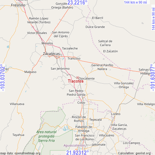
Tlacotes GPS coordinates[2]
22° 34' 26.004" North, 102° 20' 2.004" West
| Map corner | latitude | longitude |
|---|---|---|
| Upper-left | 23.2216°, | -103.03702° |
| Center: | 22.57389°, | -102.33389° |
| Lower-right: | 21.92312°, | -101.63077° |
| Map W x H: | 144.4×144.4 km | = 89.7×89.7mi |
| max Lat: | 32.7° ⇑13% North |
| Tlacotes: | 22.57389° |
| min Lat: | ⇓87% South 14.53588° |
| min Long | Tlacotes | max Long |
| -117.105° | -102.33389° | -86.73105° |
| W 16.9%⇐ | ⇒83.1% E |
Elevation
Elevation of Tlacotes is 2123 m = 6965 ft, and this is 869.3 m = 2852 ft above average elevation for this country.
| Max E: |
3497 m = 11473 ft | 20.7% |
| Tlacotes | 2123 m 6965 ft | |
| Avg. | 1253.7 m = 4113 ft | |
Min E: |
-1 m = -3 ft | 79.3% |
See also: Mexico elevation on elevation.city.
Geographical zone
Tlacotes is located in North Torrid zone (between Equator and Tropic of Cancer). Distance of this Northern Tropic circle is 95.9 km =59.6 mi to North.| Distance of | km | miles | from Tlacotes |
|---|---|---|---|
| North Pole | 7497.1 | 4658.5 | to North |
| Arctic Circle | 4891.2 | 3039.2 | to North |
| Tropic Cancer | 95.9 | 59.6 | to North |
| Equator | 2510 | 1559.6 | to South |


Nearby cities:
15 places around Tlacotes: (largest is in red/bold)
• Cerrito de la Cruz
11.3 km =7 mi,  33°
33°
• Colonia Hidalgo
12.3 km =7.6 mi,  127°
127°
• Colonia Río Verde
14.9 km =9.3 mi,  221°
221°
• Colonia Veinte de Noviembre
9.6 km =6 mi,  145°
145°
• El Refugio
4.6 km =2.9 mi,  9°
9°
• Esteban S. Castorena
14.5 km =9 mi, 148°
• Genaro Codina
15.9 km =9.9 mi,  232°
232°
• Jarillas
14.1 km =8.8 mi,  101°
101°
• La Concepción
9.5 km =5.9 mi, 132°
• Palmillas
8.7 km =5.4 mi,  347°
347°
• Paso de Méndez
15.4 km =9.6 mi,  245°
245°
• Piedra Gorda
7.4 km =4.6 mi,  178°
178°
• San Cristóbal
10.4 km =6.5 mi,  79°
79°
• San Pedro Piedra Gorda
14.1 km =8.8 mi,  186°
186°
• Soledad de Arriba
15.9 km =9.9 mi,  170°
170°
Sources, notices
• [Note1] Compared only with cities in Mexico existing in our database
• [Src1] Map data: © OpenStreetMap contributors (CC-BY-SA)
• [Src2] Other city data from geonames.org with taken over terms of usage.
• [Src3] Geographical zone / Annual Mean Temperature by Robert A. Rohde @ Wikipedia
